Pages

#850 Yanar Dag (Fire Mountain), Abseron Peninsula, Azerbaijan


This mountain is on fire! 


On the edge of a desolate moorland on a small rural road just past the pink salt lake beyond the ugly oil-field turnoff, Yanar Dag (literally Fire Mountain) burns day and night due to the underground gas that was accidentally ignited in 1958. 

A decrepit tea house is at the top of a hill, and in the gully is this amazing piece of nature. It's quite nice to sit beside the flames on a cool winter evening.
Is it natural? Well, it once was, but rumor has it that the Azeri government now pipes the gas in. However, there are other places in the area where natural gas seeps out and can be lit, including some springs and water flows. Zoroastrians worshipped fire and built a temple nearby which can still be visited. 
Mark Elliot's Azerbaijan

#851 Marianas Trench

deepseachallenge.com 
Ever since I was young I've been fascinated with the Marianas trench. The diagram above helps to show why I always found it so amazing -- we always thing about the highest point, Everest, but we rarely think about how deep the earth goes inwards, and the fact that the earth goes further inwards than it does outwards is really quite incredible. At almost 11km deep (5960 fathoms) at 'Challenger Deep' at its southern end, it is further into the earth than we can go outward although both extremes suffer from too much pressure -- altitude sickness, oxygen deprivation, atmospheric pressure, etc. I just wish it wasn't so inaccessible! 

And even though there are areas of the Arctic ocean floor that go closer to the earth's core (because Earth is not a perfect sphere and the Marianas is at its widest point in the tropics), it is a phenomenal place.

Cool facts:
  • It is 1 to 4 degrees C at the bottom.
  • Xenophyophores are a microbial bacteria life form found deep in the trench.
  • The Marianas Islands were claimed by Spain in 1668.
  • The trench was first 'sounded' in the 1870s.
  • In 1995, an unmanned remote controlled Japanese vehicle completed the deepest dive on record.
  • Four manned descents have been made, the first in 1960, and the most recent by director James Cameron in 2012.
  • Sole, flounder and shrimp have been observed at the bottom.
  • It has been proposed as a place for nuclear waste disposal, in hopes that the tectonic movements will eventually push the waste under the earth and into the earth's mantle. Thank goodness it's prohibited by international law!

#852 Cu Chi tunnels, Vietnam

The Vietnam War was one of the most brutal and violent in recent memory, with many atrocities occuring and such as strong clash of ideological beliefs in a culmination of Cold War hostilities. In Vietnam, I saw many remarkable things that represented this war, from bombed out valleys, the infamous China Beach near Da Nang, the former DMZ, and the headquarter cities of Saigon and Hanoi. 
However one of the most interesting features was the Cu Chi tunnels, a collection of the tunnels for tourists to see and get an idea of what covered vast amounts of territory and contributed enormously to the guerilla warfare -- in particular it was the base of the Viet cong during the Tet Offensive. Used for communication, supply, hospitals, storage, homes and means of movement, they were a very developed system. Despite being important to their resistance against the Americans, life in the tunnels was not particularly pleasant, as life underground with a plethora of tropical pests in abundance, and the other major killer: malaria.

The tunnels have been considerably widened and enlarged to allow for tourists, and the original trap door entrances camouflaged in the jungle floor were designed for the small Vietnamese bodies. Booby traps and other dangers were incorporated into the system including bambo spikes, cages, holes, etc. They really were an amazing piece of engineering and certainly an aid in overwhelming the Americas t

P.S. This is also one of the only posts on my blog where I am actually in the photos, which gives you a very accurate indication of how old the photos are!

#853 Ararat, Turkey (Armenia)

The cultural heart for the Armenian people lies just across the border in the home of their enemy: Turkey. Mount Ararat, known as Agri in Turkish, is a beautiful conical volcano, and can be seen from much of Armenia including the capital Yerevan, but not visited by Armenians, although it remains the spiritual, religious and nationalistic centerpiece.


Permanently snowcapped at 5137m, with two peaks, Greater Ararat and Lesser Ararat, it is Turkey's tallest, and has a 40 sq. km girth. No one knows when it last erupted, but remains suggest the Bronze Age 3 millenium BCE, although a severe earthquake shook the mountain and opened a large chasm in 1840.

According to Genesis, this is where Noah's Ark was supposed to have landed and many scientists say they have found remains of such a thing! Supposedly named after King Ara the Handsome, who didn't actually exist, but who has been associated with the real king Arame, the legends go back a long time. For Armenians it is the home of the gods, similar to Mt. Olympus in Greece.


One of the best (Armenian) places to see Ararat is from Khor Virap just outside of Yerevan, where a picturesque monastery is on a small knoll very close to the border with Mount Ararat towering behind. Beautiful! The mountain lies just 32km south of the border and is in the middle of sensitive territory where the four nations of Armenia, Azerbaijan, Iran and Turkey meet, with Armenia having poor relations with both Azerbaijan (due to the disputed Nagorno-Karabakh) and Turkey (due to their position on the Armenian Genocide).

Sources:
https://en.wikipedia.org/wiki/Mount_Ararat
https://en.wikipedia.org/wiki/Ara_the_Beautiful

#854 Blue Mountains, NSW, Australia

http://www.bluemts.com.au/
This is the view I remember, but when I saw it, I don't think there was a gondola sitting above the depths. It was my first experience of a hail stone storm -- I didn't understand how it could be so hot, yet with massive pieces of ice falling from the sky.

A short drive up from Sydney, the mountains encompass a large area of inland New South Wales. I remember how the mountains seemed to drop off, as opposed to rising up, and this would make sense considering they are a sandstone plateau with gorges being carved out of it.

The aboriginal legend is a Gundungurra creation story where the Dreamtime half-fish half-reptile creatures Mirigan and Garangatch fought a large battle, scarring the landscape. Many areas of archaeological importance are in the area (22,000 years old), with the rock shelter Red Hands Cave having ancient hand stencils and other areas having grinding stones and carved animal track images.

They were called the blue mountains because of the appearance from a distance, believed to be caused by mie scattering combined with ultraviolet radiation, and the terpenoids emitted by the many eucalyptus trees (though I admit I don't really know what that means!).

http://en.wikipedia.org/wiki/File:BlueMountains123.jpg
Source: http://www.bluemts.com.au/
http://en.wikipedia.org/wiki/Blue_Mountains_(New_South_Wales)

#855 Pink and White Terraces (Otukapuarangi), New Zealand

painting of Pink & White Terraces
John Clarke Hoyte painting. Pink and White Terraces, Lake Rotomahana and Mount Tarawera. Watercolor and gouache on paper. ca 1870s. Hocken Collections. Uare Taoka o Hakena, University of Otago.
http://www.whoi.edu/oceanus/viewImage.do?id=223993&aid=135809
This is an unusual one: The pink and white terraces are an amazing place -- however they no longer exist. Actually, they no longer exist in the form that made them famous.

http://www.buriedvillage.co.nz/pink_and_white_terraces/p/49
The pink and white terraces were two sets of beautiful geyser formations of silica terraces in Lake Rotomahana near the dormant volcano Mt. Tarawera, around 25 km south of the New Zealand town of Rotorua, but they disappeared during an 1886 eruption of Mt. Tarawera. 800m apart, it is thought they had different appearances because of the amount of sunlight they each received, with the white ones being the larger set, around 50 layers and cascading over 40m in height, and the pink ones being the preferred area for swimming.

"The journey from Auckland was typically by steamer to Tauranga, the bridle track to Ohinemutu on Lake Rotorua, by coach to Te Wairoa by canoe across lake Tarawera, and then on foot over the hill to the swampy shores of Lake Rotomahana and the terraces." (Wikipedia)
photo
http://www.virtualoceania.net/newzealand/photos/volcanic/terraces/whiteterraces.shtml
The eruption at 3am on 10 June 1886 caused the lake floor to explode, showering the area with liquid mud, ash, stones and other debris, not only reclaiming the terraces, but burying two Maori villages, Moura and Te Ariki. After the eruption, there was a crater where the terraces had been, which was eventually filled with the water of the lake

Water Basins photo
http://www.virtualoceania.net/newzealand/photos/volcanic/terraces/waterbasins.shtml
In Maori they were known as Otukapuarangi, "fountain of the clouded sky" and they were a popular tourist attraction from the 1840s, especially after Prince Albert, the Duke of Edinburgh, visited in 1870, but were a source of racist resentment from the white (pakeha) New Zealanders because the Te Arawa tribe that owned them became wealthy from their control and ownership of the area (they even had their marae (meeting house) in Hinemihi made with gold florins instead of paua (abalone shell) eyes. After the eruption killed and displaced members of the tribe, the New Zealand government unfairly converted the area into crown land in a payment-for-relief-assistance system, although much of this (including 13 lakes in 2006) has been returned to the tribe in the past decades as part of the Treaty of Waitangi tribunal.

Lake Tarawera photoLake Tarawera photo
Lake Tarawera before the eruption and today -- the eruption enlarged the lake. A narrow isthmus separates lakes Tarawera and Rotomahana.

I've been fascinated with the pink and white terraces since I was a girl and saw a beautiful painting of them. It was only after a while that I learned that they had been destroyed -- I had dreamed of visiting them!

In a marvel of modern science, the lowest two tiers of the pink terraces were rediscovered 60 metres underwater while mapping the lake floor in 2011, and it is thought that the rest may be buried under sediment, and the increased-level lake.

#856 Jesuit ranches, Cordoba, Argentina

In honor of the new Argentinian Jesuit pope just elected last week, here is a post about the UNESCO World Heritage Sites of central Argentina -- the Jesuit heritage surrounding the city of Cordoba.


I do apologize if showing photos of this tourist brochure offend --  I am not intending to copyright anything but merely to share information! It was so difficult to get information when we were in Argentina, and this was the best collection of information out there.
The first site to visit is Cordoba itself with it's Jesuit heart. Unfortunately for us, we arrived on a Sunday, so nothing was open, but we managed to get into a few of the churches and of course wander the streets.


The architect of this church was a ship builder before, which is why the roof is so reminiscent of a ship's hull, but of course, beautifully decorated. It is one of the oldest buildings in Argentina.
The streets had tiled 'shadows' which were very cool.
Cordoba Cathedral


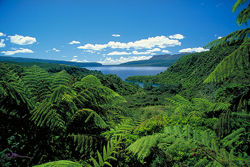
Driving north out of Cordoba, there is a straight highway, and it's easy to wonder why it was that the monasteries were built here in the middle of the plains, but the reality is, they were closer to the mountains and their rich yeilds provided the cities with food and other provisions. Warning to drivers: finding these ranches is a mission as they are poorly signposted and often in a totally different place than many brochures give the impression of.
The first mission we went to was the Jesus Maria -- a beautiful farm on the edge of the town of the same name, it is set in grounds with a large reservoir, a nearby campsite, and separate servants buildings. The church is closed, but you can enter a small upper balcony to look over it. It has a museum of art and religious relics. The toilets are interesting, especially the complicated plumbing system using water to clear out the smells and mess from what was an indoor system well before that was normal. The site was strictly non-photography and we didn't see another soul despite the folk festival that was on in the town.
 
Just down the road was the Estancia Caroya, in the middle of a tree-less field with many outbuildings showing the farm system -- a slaughterhouse, a mill, an energy generator, etc. It had a much more friendly vibe with the caretaker welcoming us in, encouraging photographs and generally wanting to make us interested in the place. It had a charming courtyard and many farm relics and furniture left from the ranch. It also had an interesting exhibition on the immigration to Argentina.


After driving truly into the rural areas away from any main roads or towns, we reached the Estancia Santa Catalina, really off in the middle of nowhere! Alas, it is closed on Mondays, but we had a lovely lunch in the gardens of the former servant quarters which is now a small bed and breakfast lodge with a lovely hostess.


The next day, after driving all over the adjacent valley, we went to Alta Gracia, which is almost back in Cordoba but on the other side of the city. On account of its closeness, this was the busiest of all the monasteries with many visitors and a crowded, overrun feeling. The hosts were no longer charming and welcoming but tired of visitors and constantly shooing people onward or telling them to leave where they weren't supposed to be! 
The only one we didn't make it to was this one: La Candelaria. It was several hours drive into the mountains, far from any other towns and very far from Cordoba. Alas, time was limited, but I bet that it is probably the prettiest and the least touristy, and the least visited. One day I will get back there, I hope! They really were peaceful places that I'm sure were absolutely amazing in their time. They would sponsor whole schools and universities in the cities and they were innovative in their time, and important community centers. All were taken over and lost to private owners in various ways when the Jesuits were banned from all the Spanish realms. And just think -- now we have a Jesuit pope!