Pages

#902 Boracay, Philippines


Idyllic, beautiful Boracay, the pride of Philippine beaches for decades, and a truly well-deserved reputation for spectacular gorgeousness! It's an island in the Visayas, and not so easy to get to considering the nearest airport is a banca boat and van/bus ride away. But of course, it's been years since I went and am sure the infrastructure is improved since 2001! What more to say about a picture-perfect, motorbikable, wanderable island in the warm Pacific Ocean with diving and snorkelling and suntanning?
 

Apologies, once again, for the poor quality scans of film photos. All you have to do is close your eyes and imagine crisp white sand beaches, turquoise oceans and tranquility and you're there, anyway.

South African Government Introduces Online Portal for Heritage Sites

South African Government Introduces Online Portal for Heritage Sites for the first time ever, South Africans are now able to air their views online regarding the protection of their cultural heritage.

South African Heritage Resources Agency
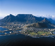
table mountain south africaThis after government through the South African Heritage Resources Agency (SAHRA) introduced a heritage resource management web based database portal, the South African Heritage Resource Information System (SAHRIS) (www.sahra.org.za/sahris). SAHRA public relations officer, Berri Samuels said the portal is an exciting, first of its kind initiative in the country.

"It takes SA heritage and puts everything into one place; it is accessible by all South Africans, through visiting the website and registering.

"This is an administrative tool that can be used by Heritage Resource Management and other bodies," she said.

Want to read UNESCO Daily News Updates? Click

Samuels said the website is created in a way that will show all online users how to explore the site, guide them on how to create and submit their applications.

"All records created from now on, may be recorded, tracked and followed up by users," she said, adding that the application include permits for archaeology, sites, heritage objects, graves and wrecks.

According to Samuels, decisions about permit applications are recorded and may now be tracked online.

"This is great progress for accessibility, transparency, prevention of loss and delays. Public may even use the web portal as a means to submit a nomination site for declaration," she said.

Project manager Nick Wiltshire said with the introduction of the web portal, all permit applications are now being submitted and recorded online.

"It's fully digitalised, it's paperless and it uses a very sophisticated GIS platform and the first website in the world where people can see a map with all the developments taking place across the country.

"If people, think that a particular proposed development in their area will result in the demolition of their heritage site, they can visit the web portal and express their objections or even leave message of support," he said.

Wiltshire said currently they have 720 users and he further urged Tourism bodies and property owners to register on the site for free.

The development of the plan began in January this year using the Drupal Content Management System platform in line with SAHRA's overall adoption of free open source software.

However, the system has been tested and used by SAHRA's employees since May this year and it is now being rolled out to all the country's nine provinces.

The system enables the efficient and coordinated management of our heritage and the maximum benefit to heritage resources by appropriate promotion and use of these resources.

SAHRA acting chief executive officer, Mmabatho Ramagoshi said: "it is a critical for South Africans to have this portal because this is where is going to ensure that all our data is streamline and every South African from whatever corner they will be able to access more information about their heritage."

The agency has already trained four heritage authorities in Kwazulu-Natal, Eastern Cape, Northern Cape and Free State. In January, more training will the done in the remaining provinces.

SAHRA which is an agency of the Department of Arts and Culture is an administrative body responsible for the protection of South Africa's cultural heritage. - SAnews.gov.za

Browse All UNESCO World Heritage Sites in . The original Source File!!!

Building a Broader History of Humanity

The History Channel recently sponsored a global teach-in in the hopes of confronting the tendency of textbooks to avoid a global approach to American history-a problem that often leads students to conclude that America’s story is largely separate from a broader history of humanity. The teach-in joined historians Albert Camarillo and Hsin-Mei Agnes Hsu with students from across the globe to discuss key events in world history that link nation-states in a shared history.

history of humanity unescoThe panel focused on UNESCO heritage sites, because, as Hsu points out: “World heritage sites are not just beautiful things, beautiful places, they tell very powerful stories.” From the slave trading forts in Ghana to the Great Wall of China to the remnants of Auschwitz, UNESCO sites draw millions of people each year, and serve as the primary source for national histories for many of these visitors. There are 962 world heritage sites, including 745 cultural, 188 natural, and 29 mixed.

The participants offered some valuable teaching tips, including how teachers can integrate world heritage sites into their curricula, and how these sites demonstrate to students how national histories often interconnect.

Want to read UNESCO Daily News Updates? Click

Integrating UNESCO Heritage Sites into Curricula

Like a historical event, highlighting a physical landmark in class discussions offers several useful dimensions for analysis for students. Eric Langhorse, a history teacher in Missouri, described how he brought UNESCO sites-including Monticello and Independence Hall- to the forefront of his teaching curriculum. Likening a UNESCO site to a microhistory, this strategy allows teachers like Langhorse to discuss a wide variety of themes central to American history within a narrow field in which students can focus.

Furthermore, integrating UNESCO sites into curricula is a gateway into approaching issues of preservation with students, and the ways in which younger generations can help preserve world heritage sites. According to Camarillo, preservation and activism is closely tied to an understanding of history. “First they have to do a little history. An appreciation of the history tied to the site … that’s when things begin to change, and you get the attention of others.”

A Global Approach to National Histories

Finally, looking at heritage sites helps students recognize the many ways in which history is a series of exchanges between disparate groups and cultures. As Camarillo noted, “Whether it the Valparaíso of Chile, whether the slave ports in Ghana, or the Sahr-i-Bahlol parks in Pakistan, the students as they learn this realize it’s not just people from localities, these are the intersecting points where people, culture from all over the world come together.”

What Camarillo suggests, then, is a much more significant shift in the way history professionals approach the education of landmarks and heritage sites. The statue of liberty, one of the most popular heritage sites in the United States, is a quintessential vista in American textbooks and yet its story is a global one—mingling with the stories of millions of immigrants greeted by the statue as they entered New York Harbor. It is links like these that demonstrate that American history does not begin or end in the United States, and approaching these global strands through heritage sites is one way to broach comparative history with K–12 students.

The AHA welcomes discussion, and would like to hear from you. Some potential questions for future discussion:

How can UNESCO heritage sites play a greater role in secondary education curricula?t

In what ways can teaching professionals promote broader issues in the history discipline through heritage sites, including preservation?

Browse All UNESCO World Heritage Sites in . The original Source File!!!

Will historical sites restore to its genuine glory?

Admitting that the department faced hardships in maintaining the historical places in Jammu and Kashmir due to years of violence, the Archaeological Survey of India (ASI) today said it will restore every such monument in the state to its pristine glory.

Restore every historical monument

Bahu Fort in Jammu and Kashmir"We will try to restore every historical monument to its pristine form. We faced difficulties during the years of violence, but now we are focusing on it," Director (Epigraphy) for Arabic and Persian Inscriptions, ASI G S Khwaja told reporters at a function here.

The function marked the commencement of the first ever 10-day travelling photo exhibition on the theme of 'Islamic Calligraphy through the Ages' at Lal Ded Memorial Cultural Centre, Ganpatyar locality of Habba Kadal in downtown Srinagar.

“There is a need to make the new generation aware about the rich cultural heritage of the state," Khwaja said.

Want to read UNESCO Daily News Updates? Click

He said calligraphy has taken the place of pictures, which are forbidden in Islam, to beautify the places of importance.

"It reflects our literal history and the coming generation have to save this art. The new generation should adopt calligraphy as a hobby," he said.

Kashmir University Vice Chancellor, Prof Talat Ahmad inaugurate the Photo Exhibition, being jointly organised by the ASI, Nagpur and J&K Chapter of Indian National Trust for Art and Cultural Heritage (INTACH).

Ninety panels showcasing four to five art forms each are on display at the exhibition which attracted hundreds of visitors within minutes of its inauguration.

Browse All UNESCO World Heritage Sites in . The original Source File!!!

Cuban Education System Improved: An UNESCO Report

The UNESCO Director General, Irina Bokova, praised here today the high quality of the Cuban literacy method Yes I can, while recognized the educational history of the country.

Cuban Education System Speaking to reporters, Bokova said Cuba is an important example for other countries in education with this method that is implemented in different regions of the planet as part of education campaigns. She added that recently had the opportunity to visit a literacy center in a community in Timor Leste that successfully applies Yes, I can, "which we are trying to enter in several African nations."

During her working visit to the Instituto Superior de Arte (ISA), declared National Monument for its high value and architectural heritage, Bokova received a detailed information of this art schools work.

The ISA rector, Rolando Gonzalez Patricio, said the center is a result of the development achieved by Cuba in art education, and since its founding in 1976, has not only received students from around the country, but also from different regions, especially in Latin America, Africa and Europe.

Want to read UNESCO Daily News Updates? Click

Gonzalez also announced that next year they will open a sixth school aimed at training professionals in conservation and restoration of art and museological works, from the experience gained in 15 years in this field.

Patricio Gonzalez highlighted the links between ISA and UNESCO through the grant system, and the feedback mechanisms they maintain with other cultures by serving as stage for important events or performances by renowned artists.

In her first visit to Cuba as director general of UNESCO, Bokova will visit the UNESCO regional headquarters for Latin America and the Caribbean, the Museum of Literacy and the International School of Film and Television in San Antonio de los Baños.

By Thursday, the last day of Bokova stay in the island, her agenda includes a meeting at the Center for Genetic Engineering and Biotechnology, and a tour of the Historical Center of Old Havana, declared in 1982 a World Heritage Site with its system of colonial fortifications.

Browse All UNESCO World Heritage Sites in . The original Source File!!!

Multi-storeyed Defensive Village Houses

Multi-storeyed defensive village houses in Kaiping display a complex and flamboyant fusion of Chinese and Western structural and decorative forms. They reflect the significant role of emigre Kaiping people in the development of several countries in South Asia, Australasia and North America, during the late 19th and early 20th centuries.

Multi-storeyed Kaiping Diaolou and Villages
Continent: Asia
Country: China
Category: Cultural
Criterion: (II) (III)(IV)
Date of Inscription: 2007

Kaiping Diaolou and Villages

In the Han period (255BC-220AD) Han people from the Central Plains of China began to move into the area and intermingled with the Yue people, who cultivated rice and fished. Settlements based on clan groupings emerged laid out according to Feng Shui principles and with houses built of mud bricks or fired bricks and timber.

From the 16th century, in response to increasing raids by bandits from the north coming into the area along the rivers, and to frequent heavy floods, villagers begun to construct fortified towers, known as Diaolou. An example is Yinglong Lou in Sanmenli Village. Following the creation of the Kaiping County in 1649, the security of the area greatly improved and few Diaolou were constructed in the Qing Dynasty: Kaiping means ‘Beginning of Peace'.

World Heritage Kaiping Diaolou and Villages
Kaiping Diaolou and Villages

Browse Gallery Plus UNESCO Storyline

From the mid-16th century, many villagers began to trade from the nearby coast, sailing in wooden junks to south-east Asia. In 1839 a poor farmer left his village and travelled to America. This was the start of a large migration of people drawn on the one hand by work on gold-fields and railroads, and prompted on the other by an increasingly difficult situation at home, brought about by warfare against Hakka migrants from the north and an increase in population which had led to food shortages. Many thousands of Kaiping villagers left the area, travelling to Macao and Hong Kong and then on to USA, Canada or Australia.

Slideshow for this Heritage Site


In North America the immigrants had to take jobs involving hard manual labour. Nevertheless by the end of the 19th century the Chinese community had begun to amass savings, and after the First World War, with rapid economic expansion in many countries, the fortunes of the overseas Chinese steadily improved. What they did not believe they had achieved however, was social recognition for their input into the expansion of the countries they had chosen to live in. Their dreams came to be associated with contributing to the wellbeing of their ancestral villages or returning to live there, and many did just that building conspicuous tower houses.

The influx of wealthy people attracted the attention of the bandits from the north who raided, robbed and kidnapped. Between 1912 and 1930, 71 incidents of banditry were recorded. The new houses needed to be built as defensive towers. The overseas Chinese also contributed to the construction of communal towers and watchtowers in most of the villages. Of the 1833 Diaolou in Kaiping, 1648 were built between 1900 and 1931, just under 90% of the total. In the same period most of the villages were built or rebuilt. In the short space of 30 years the rural landscape of Kaiping was completely transformed with funds from overseas Chinese.

The Depression of the 1930s, and the war against Japan and the Pacific war of the 1940s brought development to a halt. Between 1943 and 1947 immigration control in the USA and Canada was abolished with the result that many Chinese moved back to North America. After the establishment of the People's Republic of China in 1949, banditry was halted and flood mitigation measures were introduced: the role of the Diaolou disappeared. In the 1980s following the re-opening of China, many villagers moved away. Now many Diaolou are empty, cared for by caretakers, but still regarded by overseas Chinese as their spiritual home to which they return on family occasions or remit money for prayers to be said to their ancestors. Some still contain all their original furniture and fittings.

The surrounding villages and farmland are still part of an active rural economy, the village houses, rice fields, bamboo groves and surrounding grazed hills reflecting rural landscape patterns and practices that may have persisted for over a millennia.

Browse All UNESCO World Heritage Sites in . The original UNESCO inscription Here!!!

Buddhist Religious Complex Sites of Chinese Heritage

Buddhist Religious Complex Sites of Chinese Heritage consists The Potala Palace, Jokhang Temple Monastery and Norbulingka. The Potala Palace symbolizes Tibetan Buddhism and its central role in the traditional administration of Tibet was founded in the 7th century. The Jokhang Temple Monastery is an exceptional Buddhist religious complex. Norbulingka, the Dalai Lama's former summer palace, constructed in the 18th century, is a masterpiece of Tibetan art. The beauty and originality of the architecture of these three sites, their rich ornamentation and harmonious integration in a striking landscape, add to their historic and religious interest.

The Potala Palace Heritage Spot
Continent: Asia
Country: China
Category: Cultural
Criterion: (I)(IV)(VI)
Date of Inscription: 1994

Historic Ensemble of the Potala Palace

Construction of the Potala Palace began at the time of Songtsen of the Thubet (Tubo) dynasty in the 7th century AD. It was rebuilt in the mid-17th century by the 5th Dalai Lama in a campaign that lasted 30 years, reaching its present size in the years that followed, as a result of repeated renovation and expansion.

The Potala is located on Red Mountain, 3,700 m above sea level, in the centre of the Lhasa valley. It covers an area of over 130,000 m2 and stands more than 110 m high. The White palace is approached by a winding road leading to an open square in front of the palace. Its central section is the East Main Hall, where all the main ceremonies take place. The throne of the Dalai Lama is on the north side of the hall, the walls of which are covered with paintings depicting religious and historical themes. At the top of the White Palace is the personal suite of the Dalai Lama.

Jokhang Temple Monastery
The Potala Palace

Browse Gallery Plus UNESCO Storyline

The Red Palace

The Red Palace lies to the west of the White Palace. Its purpose is to house the stupas holding the remains of the Dalai Lamas. It also contains many Buddha and sutra halls. To the west of the Red Palace is the Namgyel Dratshang, the private monastery of the Dalai Lama. Other important components of the Potala complex are the squares to the north and south and the massive palace walls, built from rammed earth and stone and pierced by gates on the east, south and west sides.

Slideshow for this Heritage Site


Building of the Jokhang Temple Monastery began in the 7th century CE, during the Tang dynasty in China. The Tibetan imperial court eagerly espoused Buddhism when it was introduced.

The site of the Temple Monastery was selected, according to legend, when the cart in which Wen Cheng was bringing the statue of Sakyamuni sank into the mud by Wotang Lake. Divination identified this as the site of the Dragon Palace, the malign influence of which could only be counteracted by the building of a monastery. The foundation stone was laid in 647 and the first major reconstruction took place in the early 11th century. During the century following the reunification of the Tibetan kingdom by the Sakya dynasty in the mid-13th century, a number of new developments took place. These included extension of the Hall of Buddha Sakyamuni and construction of a new entrance and the Hall of Buddha Dharmapala.

The Temple Monastery is in the centre of the old town of Lhasa. It comprises essentially an entrance porch, a courtyard and a Buddhist hall, surrounded by accommodation for monks and storehouses on all four sides. The buildings are constructed of wood and stone. The 7th Dalai Lama is reported to have had health problems and he used to come here for a cure.

The construction of Norbulingka started in 1751 with the Uya Palace. Successive Dalai Lamas continued building pavilions, palaces and halls, making it their summer residence, and soon the site became another religious, political, and cultural centre of Tibet, after the Potala Palace. Norbulingka (treasure garden) is located at the bank of the Lhasa River about 2 km west of the Potala Palace. The site consists of a large garden with several palaces, halls, and pavilions, amounting to some 36 ha. The area is composed of five sections.

Browse All UNESCO World Heritage Sites in . The original UNESCO inscription Here!!!

#903 Gold Souq, Dubai, UAE

I never really knew what rich was until I visited the Gold Souq in Dubai. It was a sweltering mid-July day when if you're wearing glasses and you try and go from inside to outside, they immediately fog up because of the humidity. It is so sweaty that being outside for any length of time is draining. The gold souq was empty, but the gleaming windows were free of onlookers so we could gawp all we wanted! Wow -- so much yellow (the preferred variety in this part of the world as purity is more important than durability). So big! So much! It's not much more than a block or two, but it feels like the concentration of shops and jewelry makes up for its small size. I could wander and find a favorite design or simply marvel at the styles. Some are ugly and others elegant. Some can clearly only be afforded by a rich oil baron, but almost all is intended to be part of a dowry. An amazing cultural exchange!


Will Armenian Cathedral of Holy Savior become World Heritage Site?

Entering Isfahan’s Armenian Cathedral of the Holy Savior on the UNESCO's World Heritage List is among the priorities of our organization, Head of the Cultural Heritage, Handicrafts and Tourism Office in Isfahan Province Mohsen Moslehi told Iran’s news agency IRNA in an interview.

Armenian Cathedral of the Holy SaviorAccording to Moslehi, the Armenian Cathedral of the Holy Savior, one of the valuable historical monuments in Isfahan, attracts many tourists from around the world. Referring to Armenian cultural monuments located in the territory of Iran, deputy head of Iranian Cultural Heritage Organization Masoud Alavian Sadr said to Iran’s news agency Fars recently in an interview, “Karakilisa Church located in Iran’s West Azarbaijan Province has already been entered on the UNESCO's World Heritage List along with 9 Iranian cultural and historical monuments. Another Armenian church, St. Mary, is located in Maku, West Azarbaijan. St. Stephanos (10-12 centuries) is another significant Armenian church, which is located in Julfa, East Azarbaijan Province, on the bank of Arax River.”

Want to read UNESCO Daily News Updates? Click

Armenian Cathedral of the Holy Savior Interior Isfahan Iran
Armenian Cathedral of the Holy Savior Interior

Armenian Cathedral of Holy Savior

Holy Savior Cathedral also known as Vank Cathedral and The Church of the Saintly Sisters, is a cathedral in Isfahan, Iran. Vank Cathedral was one of the first churches to be established in the city's Jolfa district by Armenian immigrants settled by Shah Abbas I after the Ottoman War of 1603-1605.

The varying fortunes and independence of this suburb across the Zayandeh River and its eclectic mix of European missionaries, mercenaries and travellers can be traced almost chronologically in the cathedral's combination of building styles and contrasts in its external and internal architectural treatment.

Browse All UNESCO World Heritage Sites in . The original Source File!!!

Clean and Tidy programme to maintain heritage sites

The State Tourism Department, in association with the Indian National Trust for Art and Cultural Heritage (INTACH), will form a five-member committee for cleaning and maintaining hygiene at heritage sites in the State, besides, marketing Tiruchendur Kanda Sashti festival in a big way.

Under the clean and tidy programme

Clean and Tidy programme Under the clean and tidy programme, the department initially plans to cover Mamallapuram, Thanjavur Birhadeeswara Temple, Kanyakumari, Rameswaram, Tranquebar, Madurai Meenakshi temple, Srirangam temple, Tiruchi, Tiruvannamalai temple, Velankanni, Udhagamandalam and Kodaikanal. A meeting under the chairmanship of Tourism Minister S. Gokula Indira was held on Wednesday in which representatives of Archaeology Survey of India, Tourism Department, Municipal Administration, HR&CE, INTACH (Puducherry and Chennai regions) were present.

It was resolved to prepare and submit an action plan within a week and form action committee at each site. It was also suggested to form friends of monuments group with the help of local self-help groups and collect cess along with the entry ticket by creating a separate fund account. The amount should be used for keeping the area neat and clean.

An official release said the five-member committee would carry out site inspection to implement the action plan in selected areas, proper care had to be taken at planning stage to avoid any hindrance to the existing heritage structure, while creating new structures around it.

Want to read UNESCO Daily News Updates? Click

While expressing concern over the illegal encroachments by shoppers in Tiruvannamalai ‘girivalam path’ the members said necessary action should be initiated to clear them so that it would enable tourists/pilgrims to have free access to the pathway.

Browse All UNESCO World Heritage Sites in . The original Source File!!!

Southern African Primary School Enrolment Slowing Down

Enrolment into primary schools is slowing down in Sub-Saharan Africa especially Nigeria, Country Director of the United Nations Educational, Scientific and Cultural Organisation (UNESCO), Joseph Ngu, said in Abuja.

Very strong political will improve literacy rates

Southern African Nigerian Education SystemNgu, who spoke at the Revitalizing Adult and Youth Literacy in Nigeria project review said, "very strong political will" is required to ensure that literacy rates improve to move Nigeria closer to achieving Education For All (EFA). He said the global economic crisis is threatening to erode past successes achieved under the EFA initiative but UNESCO is intensifying efforts to make quality education a reality for all.

He said the international community acknowledges efforts of the Nigerian government to improve literacy not only by committing financial resources but also its level of cooperation with UNESCO.

Minister of State for Education Barrister Nyesom Wike said Nigeria as one of the countries with the highest number of illiterates will continue to collaborate with International Development Partners (IDPs) to increase access to quality education.

Want to read UNESCO Daily News Updates? Click

Executive Secretary of the National Commission for Mass Literacy, Adult and Non-Formal Education (NMEC), Jibrin Paiko, said to reach its target of educating 30 million illiterates by 2015, the commission is working towards increasing enrolment of learners and expanding mass literacy centres nationwide.

Browse All UNESCO World Heritage Sites in . The original Source File!!!

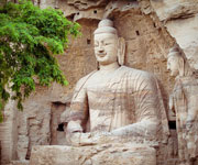
The Buddhist tradition of religious cave art

The Buddhist tradition of religious cave art achieved its first major impact at Yungang, where it developed its own distinct character and artistic power. The Yungang cave art represents the successful fusion of Buddhist religious symbolic art from south and central Asia with Chinese cultural traditions, starting in the 5th century AD under imperial auspices. At the same time it vividly illustrates the power and endurance of Buddhist belief in China.

Buddhist tradition Yungang Grottoes
Continent: Asia
Country: China
Category: Cultural
Criterion: (I) (II) (III)(IV)
Date of Inscription: 2001

Yungang Grottoes in Datong, China

Datong, known as Pingcheng in ancient times, became the capital of the Northern Wei dynasty between 398 and 494, and thus the political, economic and cultural centre of their kingdom. It kept its importance until 523, when it was deserted following a revolt. The statues of the Yungang Grottoes were completed in sixty years (460-525); this period marks the peak of development in Buddhist cave art of the Northern Wei dynasty. When the first emperor assumed the throne, Buddhism flourished and in 460 the monk Tan Yao started the carving of the Five Caves; since then, these grottoes have become the centre of Buddhist art in North China.

By 525 the initial project, sponsored by the court, was mostly completed, but low ranking officials and monks continued to dig more caves and carve statues. During the Liao dynasty, wooden shelter structures were built in front of the caves, turning the grottoes into temple buildings, such as the Ten Famous Temples. In 1122 these temples were destroyed in a war.

Yungang Grottoes in Datong China
The Yungang cave art

Browse Gallery Plus UNESCO Storyline

Wuzhoushan Grottoes

The Yungang Grottoes, known as Wuzhoushan Grottoes in ancient times, are located on the southern foot of the Wuzhou Mountains, in the Shi Li River valley, 16 km west of Datong City. They consist of 252 caves of various sizes housing more than 51,000 statues; the site extends much as 1 km east-west. Three main periods can be identified in the construction: the Early Period (460-65), the Middle Period (c 471-94) and the Late Period (494-525). Apart from the grottoes, the nominated core area includes the remains of a castle, a defence wall, and a beacon tower of the Ming dynasty on the plain above the grottoes.

Slideshow for this Heritage Site


The grottoes of the early period (460-65) are composed of five main caves; these magnificent and simple caves were dug under the direction of the monk Tan Yao and are named after him. For the layout of the grottoes, large caves were dug to house the giant statues, 13-15m tall. They have a U-shaped plan and arched roofs, imitating the thatched sheds in ancient India. Each cave has a door and a window. The central images have tall bodies and occupy the major part of the caves, while on the outer walls 1,000 Buddhist statues are carved, a feature rarely seen in the tradition of Chinese history of grotto carving.

They form the essence of the Yungang Grottoes, consisting of large caves, including four groups of twin caves and one group of triple caves. In this period there was a rapid development of the Han style and many new subject matters and combinations of statues were introduced, shifting the attention to the creation of law-enforcing images and various kinds of adornment. These caves are square in plan, usually with chambers both in front and in the rear; carvings on the walls are divided into upper and lower bands and right and left sections. Level caisson ceilings are carved on the roofs in most cases. On both sides of the outer walls there are high double-floored attics, and monuments stand high in the centre of the courtyard.

The shelters in the style of wooden structures are supported by octagonal pillars, each carved with 1,000 Buddhas. The walls inside the caves are covered by long rolls of paintings divided into different layers and columns. All these reflect the layouts and traditional arrangements of halls in vogue in China during the Han dynasty.

The grottoes of the late period (494-525) are located in the west of the grotto area, in the Dragon King Temple Valley. In total, over 200 caves and niches were cut in this period. These caves are of medium and small size with varied and complicated irregular shapes. Decorations were also carved on the cliff around the door of the caves. There is a tendency towards simplification of the contents of the statuary and stylizing the forms, but with a new look of delicacy and gracefulness.

Browse All UNESCO World Heritage Sites in . The original UNESCO inscription Here!!!

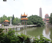
China’s world heritage tentative list adds Fuzhou historic sites

Sanfang Qixiang (Three Lanes and Seven Alleys) and the “Maritime Silk Road”, two historic sites in Fuzhou, were included on China’s World Cultural Heritage Tentative List by the State Administration of Cultural Heritage (SACH) at the World Cultural Heritage Conference held in Beijing on Nov 17. This is the first time that Fuzhou heritage sites made the list. It marks a significant step forward in UNESCO World Heritage recognition.

Fuzhou historic sites

World Heritage Sanfang QixiangWorld Heritage sites refer to natural landscapes and cultural relics with prominent significance and universal values confirmed by UNESCO and the World Cultural Committee. Fuzhou co-submitted the “Maritime Silk Road” with seven other cities, Guangzhou, Quanzhou, Zhangzhou, Ningbo, Yangzhou, Penglai and Beihai, for the tentative list. Historic sites along the “Maritime Silk Road” include King Langya’s Benevolent Rule Stele in Gulou district.

In February, the Fuzhou government finished its application paperwork and heritage planning work and officially applied to the SACH.

Want to read UNESCO Daily News Updates? Click

World Heritage Maritime Silk Road
Maritime Silk Road

Fuzhou

Fuzhou is the capital and one of the largest cities in Fujian Province, People's Republic of China. Along with the many counties of Ningde, those of Fuzhou are considered to constitute the Mindong linguistic and cultural area.

Fuzhou's core counties lie on the north bank of the estuary of Fujian's largest river, the Min River. All along its northern border lies Ningde, and Ningde's Gutian County lies upriver. Fuzhou's counties south of the Min border on Putian, Quanzhou, Sanming and Nanping municipalities. Its population is 7,115,370 inhabitants at the 2010 census whom 4,408,076 inhabitants are urban standing around 61.95%, while rural population is at 2,707,294 standing around 38.05%.

Browse All UNESCO World Heritage Sites in . The original Source File!!!

#904 Musandam Peninsula, Oman

Very few people, if they know where Oman is, know about the enclave of Oman at the northern tip of Arabia, jutting into the straits of Hormuz. The most common visitors tend to be from the United Arab Emirates, as it is much closer than the main cities of Oman proper. Forming the land barrier between the Indian Ocean and the Arabian/Persian Gulf, the geology is similar to that of Oman on the other side, and is an ancient rock formation of spectacular arrangement. With barely one sealed road, and many off-road 4WD excursions available, it is a place to go with your own car. 

The main town on the western (and more developed side) is Khasab, but really, it is a one-service station town, with only a handful of hotels and even fewer restaurants. It is the setting off point for cruises into the isolated bays of Musandam, where you can find Telegraph Island, where poor souls were stationed for months on end to man the British telegraph station that was connecting continents here.

Because most of the peninsula is made up of small primitive villages, little has changed in the past millenia. Rock art can be seen in many villages, and the animal life is great -- many egrets and other birds nestle on the sea-side rocks, while dolphins frolic through the bays jumping over the wake of the relatively few boats that visit. Most boats are in the image of the ancient dhows that have plied the water routes across the gulf for centuries - a lovely day out!
Source: http://en.wikipedia.org/wiki/Musandam_Governorate 

The Pitons Management Area Volcanic System

The Pitons Management Area contains the greater part of a collapsed stratovolcano contained within the volcanic system, known to geologists as the Soufriere Volcanic Centre. Prominent within the volcanic landscape are two eroded remnants of lava domes, Gros Piton and Petit Piton.

The Pitons Management Area Volcanic System
Continent: North America
Country: Saint Lucia
Category: Natural
Criterion: (VII)(VIII)
Date of Inscription: 2004

Pitons Management Area

Dominating the mountainous landscape of St Lucia are the Pitons, two steep-sided volcanic spires rising side by side from the sea. 770 metre Gros Piton is 3 km in diameter at its base, and Petit Piton (743 m) is 1 km in diameter and linked to the former by the Piton Mitan ridge. The Pitons are part of a volcanic complex, known to geologists as the Soufriere Volcanic Centre which is the remnant of one (or more) huge collapsed stratovolcano. The volcanic complex overlies a tectonic plate subduction (underthrusting) zone which stretches 700 km along Lesser Antilles, forming a volcanic arc.

The Pitons are the eroded cores of two lava domes formed on the flanks of the stratovolcano. Today they tower above a caldera-like formation, produced by a gigantic gravity slide or structural collapse which formed the Qualibou Depression, 7 km in diameter. Near the centre of the depression are the Sulphur Springs, an active, high temperature geothermal field with sulphurous fumaroles and hot springs. The Pitons occur with a variety of other volcanic features including cumulo-domes, explosion craters, pyroclastic deposits (pumice and ash) and lava flows. Collectively, these fully illustrate the volcanic history of an andesitic composite volcano associated with crustal plate subduction.

Pitons Management Area

Browse Gallery Plus UNESCO Storyline

The Marine Management Area is a coastal strip 11 km long and about 1 km wide. It comprises a steeply sloping continental shelf with fringing and patch reefs, boulders and sandy plains. The coral reefs, which cover almost 60% of the marine area, are healthy and diverse. A survey to a depth of 20 m revealed 168 species of finfish, 60 species of cnidaria, including corals, molluscs, sponges, echinoderms, arthropods and annelid worms. Hawksbill turtles are seen inshore, and whale sharks and pilot whales offshore.

Slideshow for this Heritage Site


The dominant terrestrial vegetation is tropical moist forest grading to subtropical wet forest with small areas of dry forest near the coast and on steep slopes, and areas of wet elfin woodland on the summits. On the Pitons especially, small undisturbed natural forests remain, preserved by the steepness of the land. At least 148 plant species have been recorded on Gros Piton and 97 on Petit Piton. Among these are several endemic or rare plants, including eight rare species of tree. Some bird species, including 5 endemics, are known from Gros Piton, along with indigenous rodents, opossum, bats, reptiles and amphibians.

The area is a multiple-use management where agriculture, artisan fishing, human settlement (1,500 residents) and tourism (four large hotel developments) are allowed. There are four distinctions of the PMA which it proposes are of universal value

Browse All UNESCO World Heritage Sites in . The original UNESCO inscription Here!!!

The Heritage City of Meknes Morocco

The Heritage City of Meknes has exerted a considerable influence on the development of the civil and military architecture and works of art. The name of Meknes goes back to the Meknassa, the great Berber tribe that dominated eastern Morocco to as far as the Tafililet and which produced Moulay ldriss I, founder of the Moroccan state and the ldrissid dynasty in the 8th century AD.

The Heritage City of Meknes Morocco
Continent: Africa
Country: Morocco
Category: Cultural
Criterion: (IV)
Date of Inscription: 1996

The Almoravid period

The Almoravid rulers (1053-1147) made a practice of building strongholds for storing food and arms for their troops; this was introduced by Youssef Ben Tachafine, the founder of Marrakech. Meknes was established in this period, at first bearing the name Tagrart. The earliest part to be settled was around the Nejjarine mosque, an Almoravid foundation. Markets congregated around the mosque, specializing in firearms, woodwork, metal products, etc. Like other settlements of the time, Meknes was not fortified: walls were not added until the end of the Almoravid period.

The town fell into the hands of the Almohad dynasty (1147-1269) at the start of their rule: it was taken by an army led by the caliph Abdelmoumen in person. During this period it was enlarged and urbanized. An inscription states that the Great Mosque was enlarged during the reign of Mohamed Annacer (1199-1213). Water from the Tagma spring was brought to the town to serve the various fountains, baths, and mosques. At that time there were four sets of baths (hammam), the location of which indicates how the town had spread.

The World Heritage City Meknes Morocco
The Heritage City of Meknes Morocco

Browse Gallery Plus UNESCO Storyline

During the subsequent Merinid period (1269-1374) Meknes absorbed the suburbs that had grown up round it. Refugees from the Moorish centres in Andalusia that fell to Christian forces also helped to swell the population, among them a significant Jewish community. Following Merinid practice, Abou Youssof (1269-86) built a kasoan (only the mosque of which survives) outside the old town, as well as the first of the three medersa (Islamic schools) with which the Merinid rulers endowed Meknes. Other public buildings from the Merinid period included mosques, hospitals, libraries, and fountains.

Slideshow for this Heritage Site


The founder of the Alaouite dynasty, Moulay lsmaTI (1672-1727), made Meknes his capital city and carried out many reconstructions and additions, such as mosques, mausolea, and gardens, but his main contribution was the creation of a new imperial city. Built in the Hispano-Moorish style, it is impressive in both extent and construction. lt is enclosed by high walls pierced by monumental gates. Within are the palace with its enormous stables, a military academy, vast granaries, and water storage cisterns.

Browse All UNESCO World Heritage Sites in . The original UNESCO inscription Here!!!