Pages

Showing posts with label Asian Heritage Sites. Show all posts

Temples and Monasteries of Mount Wutai

According to the Records of Mount Qingliang, written by Buddhist master Zhencheng in the Ming Dynasty, the first temple built on Mount Wutai was created by the order of the Han Emperor in AD 68. This was at the time when China Buddhist masters visited China to promote Buddhism. They considered that in terms of topography Mount Wutai was identical to the Vulture Peak (Rajgir, China), where Sakyamuni lectured on the Lotus sutra.
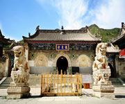
mount wutai heitahe temples
Continent: Asia
Country: China
Category: Cultural
Criterion: (II)(III) (IV) (IX)
Date of Inscription: 2009

Mount Wutai

During the North and South Dynasties, through the patronage of Emperors who started the pilgrimages to the five peaks, Mount Wutai flourished with over 200 temples and monasteries. From an early date a link was established between Mount Wutai and the worship of Manjusri, a bodhisattva associated with wisdom. A sutra dating from AD 418, the Residence of Bodhisattva, Scroll 45, identifies Qingliang Mountain as the dwelling place of Manjusri and this mountain is usually taken as being Mount Wutai.

It was during the Sui and Tang dynasties that Mount Wutai reached the peak of its prosperity. All the Tang Emperors awarded imperial edicts for such matters as building, exempting from taxation, drawing up maps or putting the monks and nuns from the entire nation under the control of the monasteries at Wutai, thus making it the centre of Han Buddhism. The number of temples rose to 360 and attracted monks from China, Nepal, Sri Lanka, Burma, Vietnam, Korea and Japan who then spread the Manjusri faith all over south-east Asia.

the heritage mount wutai
The Heritage Mount Wutai

Browse Gallery Plus UNESCO Storyline

During the Song and Yuan Dynasties the number of temples declined to around 70 but new halls were built including the Manjusri Hall of Foguang Temple. Tibetan Buddhism spread to Mount Wutai and coexisted harmoniously with Han Buddhism.

Slideshow for this Heritage Site


Buddhism flourished once more in the Ming dynasties and many temples were rebuilt, including the Great White pagoda and a public Sukhavati monastery. The number of temples increased once more to 104. The Qing Emperors undertook many pilgrimages to Mount Wutai as part of their policy to show ethnic solidarity with neighbouring Mongolians, to strengthen the borders, and to foster social stability. By this time there were 25 Tibetan lamaseries and 97 Han Buddhist communities working side by side.

From the late Qing dynasty to the early years of the Republic of China, Mount Wutai declined through social instability. Since 1949 and the founding of the People's Republic of China, efforts have been directed at reviving and protecting the buildings. There are now 68 temples on the mountain: 21 outside and 47 inside the circle of the five terraces; 7 Tibetan lamaseries and 40 Han Buddhist monasteries; 5 nunneries and 1 public monastery.

Until the 1950s, the temples had as a backdrop to the northwest the mountain slopes afforested with Wutai small poplar, Chinese pine, spruce and small wild shrubs. In the east was the Qingshui River and to the south arable land worked in terraces to support the monks and local residents. With the sudden increase in population in the 1950s, much of the forested land to the northwest was cleared and turned into agricultural terraces, although because of the comparatively high altitude the output was low.

In the 1990s with fewer people engaged in agriculture, a large part of this arable land was abandoned, causing soil erosion. At the end of 1990s, in order to protect the ecological environment, and under a national policy to return farmland to forest, the government has started a five year programme of afforestation, planting pines, including the local Chinese pine, and spruce, supplemented by local small shrub.

In the past five years many residents living in Taihuai town have been moved to a new Jingangku Township, 16 kms away where new dwellings and tourist facilities have been built. When the project is complete in 2020, 395 households will have been moved from six villages as well as from the settlements of Dongzhuang and Guizicun and 36 hotels and 108 shops.

Browse All UNESCO World Heritage Sites in . The original UNESCO inscription Here!!!

Sichuan Giant Panda Sanctuaries

Sichuan Giant Panda Sanctuaries - Wolong, Mt Siguniang and Jiajin Mountains is principally renowned for its importance for the conservation of the giant panda, recognized as a "National Treasure" in China and as a flagship for global conservation efforts. The property is the largest and most significant remaining contiguous area of panda habitat in China and thus the world. It is also the most important source of giant panda for establishing the captive breeding population of the species.

Giant Panda Sanctuaries
Continent: Asia
Country: India
Category: Natural
Criterion: (X)
Date of Inscription: 2006

Giant Panda

In addition to the giant panda, the property features a great number of endemic and threatened species of plants and animals, including other iconic mammal species such as the red panda, snow leopard and clouded leopard among the 109 species of mammals recorded (more than 20% of all Chinese mammals). The property is an important centre of endemism for some bird taxa with 365 bird species recorded, 300 of which breed locally.

However the property is particularly important for flora, being one of the botanically richest sites of any temperate region in the world with some 5,000 – 6,000 species recorded. Many species are relicts, such as the dove tree, and there is significant diversity in groups such as magnolias, bamboos, rhododendrons, and orchids. The property is a major source and gene pool for hundreds of traditional medicinal plants, many now under threat.

Sichuan Giant Panda Sanctuaries

Browse Gallery Plus UNESCO Storyline

Location of Sichuan

Located in China's southeast province of Sichuan in the Qionglai and Jiajin Mountains between the Chengdu Plateau and the Qinghai-Tibetan Plateau, the property includes seven nature reserves and eleven scenic parks in four prefectures or cities. It covers a total area of 924,500 ha surrounded by a buffer zone of 527,100 ha.

The Sichuan Giant Panda Sanctuary includes more than 30% of the world's population of giant Panda and constitutes the largest and most significant remaining contiguous area of panda habitat in the world. It is the most important source of giant panda for establishing the captive breeding population of the species.

Slideshow for this Heritage Site


The property is also one of the botanically richest sites of any temperate region in the world or indeed anywhere outside of the tropical rain forests. Underlining the outstanding value is that it protects a wide variety of topography, geology, and plant and animal species. The property has exceptional value for biodiversity conservation and can demonstrate how ecosystem management systems can work across the borders of national and provincial protected areas.

Browse All UNESCO World Heritage Sites in . The original UNESCO inscription Here!!!

Three Parallel Rivers of Yunnan Protected Areas

Three Parallel Rivers of Yunnan Protected Areas is situated in south-west China. The site consists of 15 protected areas (in eight geographical clusters) in the mountainous north-west of Yunnan Province.

Three Parallel Rivers of Yunnan
Continent: Asia
Country: China
Category: Natural
Criterion: (VII)(VIII) (IX) (X)
Date of Inscription: 2010

Three of the great rivers of Asia

Extending 310 km from north to south and 180 km from east to west, the site encompasses large sections of three of the great rivers of Asia, the Yangtse (Jinsha), Mekong (Lacang) and Salween (Nu Jiang), which run parallel from north to south through the nominated area for over 300 km.

The world heritage area lies over four parallel north-south trending mountain ranges that reach a height in excess of 4,000 m above sea level in altitude. These ranges are part of the Hengduan Mountains located beyond the eastern end of the Himalayas, which have been corrugated and uplifted by the pressures of crustal folding.

Three Parallel Rivers of Yunnan Protected Areas

Browse Gallery Plus UNESCO Storyline

The site is dominated by a huge composite orogenic belt that shows the signs of powerful crustal movements in the past. Notably is the compression of the edge of the Eurasian plate by the underlying Indian plate which is being subducted along the line of the Lancang River fault. The resulting squeeze created vast thrust-nappes; violent shearing and uplift into high mountains, through which pre-existing rivers continue to cut, resulting in the extreme vertical relief which characterizes the area. Some of the results are visible in complex patterns of folded rock and unusual mineral formations.

Slideshow for this Heritage Site


The site is also an excellent representative of alpine landscapes and their evolution. The eastern mountains, plateaus and valleys are covered with meadows, waterfalls and streams and hundreds of small glacial lakes left by glacial erosion processes.

The land area encompassed by Three Parallel Rivers of Yunnan Protected Areas is one of the world's least-disturbed temperate ecological areas, an epicentre of Chinese endemic species and a natural gene pool of great richness. It supports the richest diversity of higher plants of China, owing to its altitudinal range and its position in a climatic corridor between north and south, it includes the equivalents of seven climatic zones: southern, central and northern subtropical with dry hot valleys, warm, cool and cold temperate, and cold zones. Owing to its function as a refuge during the last Ice Age and its location near the boundaries of three major biogeographic realms, East Asia, South-East Asia and the Tibetan plateau, the park has 22 vegetation subtypes and 6,000 plant species.

The fauna is a complex mosaic of Palaearctic, oriental and local endemic species adapted to almost all the inland climates from southern subtropical to frigid, except for desert, although there are hot dry valleys. The area is believed to support over 25% of the world's animal species, many being relict and endangered. There is a concentration of the country's rare and endangered animals within the nominated area.

Being near the boundaries of the East Asian, South-East Asian and Tibetan biogeographic realms, the nominated area also acts as a corridor where several species from each realm meet and reach their limits of distribution. In addition there are numerous primitive animals that are relics of the ecological past, alongside animals that have recently adapted to colder conditions.

Browse All UNESCO World Heritage Sites in . The original UNESCO inscription Here!!!

The Dujiangyan Irrigation System

The Dujiangyan Irrigation System, begun in the 2nd century BC, is a major landmark in the development of water management and technology, and is still discharging its functions perfectly. It graphically illustrates the immense advances in science and technology achieved in ancient China. The temples of Mount Qingcheng are closely associated with the foundation of Taoism, one of the most influential religions of East Asia over a long period of history.

The Dujiangyan Irrigation System
Continent: Asia
Country: China
Category: Cultural
Criterion: (II)(IV) (VI)
Date of Inscription: 2000

Land of Abundance

In 256 BC Li Bing, Shu Kingdom magistrate of the Qin dynasty, selected the mountain outlet of the Minjiang River, with its abundant water flow, as the site for an irrigation system. This involved cutting the Lidui platform, digging canals to avoid the risk of flooding, and opening up a navigation route; at the same time the neighbouring farmland would be irrigated, creating a 'Land of Abundance'.

During the Tang dynasty (618-907) large-scale water conservancy and irrigation projects were carried out. The system was rationalized during the Song dynasty (960-1279) into three main water-courses, three canals and fourteen branches, with coordinated maintenance and water control. During the Yuan dynasty (1206-1368) additional projects were carried out, and this process continued throughout the Ming dynasty (1368-1644). Incessant warfare at the end of the Ming dynasty and the early years of the Qing dynasty (1644-1913) resulted in the system falling into disrepair, but this was eventually set to rights.

The Dujiangyan Irrigation System in Asia
The Dujiangyan Irrigation System

Browse Gallery Plus UNESCO Storyline

In AD 142 the philosopher Zhang Ling founded the doctrine of Taoism on Mount Qingcheng, and in the following year he took up permanent residence in what became known as the Celestial Cave of the Tianshi (the name given to the spiritual head of the Taoist religion). During the Jin dynasty (265-420) a number of Taoist temples were built on the mountain, and it became the centre from which the teachings of Taoism were disseminated widely throughout China.

Slideshow for this Heritage Site


The irrigation system consists of two principal components, the Weir Works and the irrigated area. The Weir Works form the heart of the system. It receives water from the upper valley of the Minjiang River. There are three main elements. The Yuzui Bypass Dyke is located at the outfall of the Minjiang River. Water from the upper valley is diverted into the Outer and Inner Canals: the former follows the course of the Minjiang River and the latter flows to the Chengdu plain through the Baopingkou Diversion Passage. It serves the essential function of bypassing the considerable amount of silt brought down by the river. It makes full use of the bend, directing surface water with low concentrations of silt into the Inner Canal and the heavily silted deeper water into the Outer Canal.

The Feiyashan Floodgate is situated between the lower end of the Yuzui Bypass Dyke and the V-Shaped Dyke. Its upper end is 710 m from the Bypass Dyke and 120 m from the Baopingkou Diversion Passage. The principal function of the Floodgate is to transfer overflow, together with silt and pebbles, from the Inner to the Outer Canal. When water flow in the Inner Canal is low, the Floodgate ceases its draining function and transfers water into the Weir Works to ensure the supply of irrigation water to the Chengdu Plains.

The Baopingkou Diversion Passage lies between the Lidui Platform south of Dujiangyan City and the cliff facing it, an enormous engineering project that dates back to the beginning of the Irrigation System in the 3rd century BC. It is able to control and maintain the water flow to the Chengdu irrigated plains automatically, even in periods of drought or flooding.

Mount Qingcheng dominates the Chengdu plains. There are eleven temples on Mount Qingcheng of special significance in the field of Taoist architecture because, unlike Mount Wudang temples, they do not reproduce the features of imperial courts but the traditional architecture of western Sichuan.

The Erwang Temple west of Dujiangyan City was considerably enlarged during the Song dynasty (960-1279) and substantially reconstructed in the 17th century. It is constructed of wood and is located on a commanding point of the mountain, overlooking the river. The carvings inside the temple record the history and achievements of water control.

Browse All UNESCO World Heritage Sites in . The original UNESCO inscription Here!!!

Mount Sanqingshan Granite Peaks and Granite Pillars

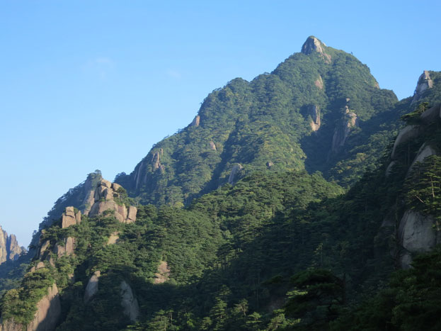
Mount Sanqingshan National Park, a 22,950 ha property located in the west of the Huyaiyu mountain range in the northeast of Jiangxi Province (in the east of central China) has been inscribed for its exceptional scenic quality, marked by the concentration of fantastically shaped pillars and peaks: 48 granite peaks and 89 granite pillars, many of which resemble human or animal silhouettes.

Natural Heritage Mount Sanqingshan National Park
Continent: Asia
Country: China
Category: Natural
Criterion: (VII)
Date of Inscription: 2008

Mount Sanqingshan National Park

The natural beauty of the 1,817 metre high Mount Huaiyu is further enhanced by the juxtaposition of granite features with the vegetation and particular meteorological conditions which make for an ever-changing and arresting landscape with bright halos on clouds and white rainbows. The area is subject to a combination of subtropical monsoonal and maritime influences and forms an island of temperate forest above the surrounding subtropical landscape. It also features forests and numerous waterfalls, some of them 60 metres in height, lakes and springs.

Mount Sanqingshan National Park displays a unique array of forested, fantastically shaped granite pillars and peaks concentrated in a relatively small area. The looming, intricate rock formations intermixed with delicate forest cover and combined with ever-shifting weather patterns create a landscape of arresting beauty.

Mount Sanqingshan National Park

Browse Gallery Plus UNESCO Storyline

Superlative natural phenomena or natural beauty: Mount Sanqingshan’s remarkable granite rock formations combine with diverse forest, near and distant vistas, and striking meteorological effects to create a landscape of exceptional scenic quality. The most notable aspect is the concentration of fantastically shaped pillars and peaks.

The natural beauty of Mount Sanqingshan also derives from the juxtaposition of its granite features with the mountain’s vegetation enhanced by meteorological conditions which create an ever-changing and arresting landscape. The access afforded by suspended walking trails in the park permits visitors to appreciate the park’s stunning scenery and enjoy its serene atmosphere.

Slideshow for this Heritage Site


The park boundaries are appropriately drawn to protect the naturalness of the landscape and the areas required to maintain the scenic qualities of the property. The property, although relatively small, includes all of the granite peaks and pillars which provide the framework for its aesthetic values. Boundaries are accurately surveyed and demarcated. The property’s integrity is enhanced by the designation of a buffer zone that is not part of the inscribed property.

The property has effective legal protection, a sound planning framework and is currently well managed. The park benefits from strong government support and funding. The park’s natural resources are in good condition and threats are considered manageable. There is an effective management regime in place for the park.

The key requirement is to manage the property to retain its aesthetic values, and a delicate balance will need to be maintained with the provision of visitor access. The most significant threat relates to the future increase in tourism, and careful and sensitive planning of the related infrastructure and access development is required.

Browse All UNESCO World Heritage Sites in . The original UNESCO inscription Here!!!

The World Heritage Mount Emei

The World Heritage site is an area of natural beauty by virtue of its high plant species diversity, with a large number of endemic species. It also underlines the importance of the link between the tangible and intangible, the natural and the cultural. The Mount Emei (Emishan) area possesses exceptional cultural significance, as it is the place where Buddhism first became established on Chinese territory and from where it spread widely throughout the East.

Mount Emei Scenic Area
Continent: Asia
Country: China
Category: Mixed Heritage Property
Criterion: (IV)(VI) (X)
Date of Inscription: 1996

Heritage Mount Emei

Heritage Mount Emei is located in central Sichuan Province, the nominated area includes Mount Emei Scenic and Historical Area, west of Emeishan City, and the Leshan Giant Buddha Scenic Area, south-east of Leshan City at the confluence of three rivers: Minjiang, Dadu and Qinqyi.

Mount Emei, with its characteristic three summits, rises 2,600 m from the western margin of the Chengdu Plain. Its diverse topography includes a range of undulating hills, valleys, deep gullies and high peaks. Sedimentary rocks from the late Precambrian contain a large number of fossils and are an important source of geological information.

Leshan Giant Buddha Scenic Area

Browse Gallery Plus UNESCO Storyline

Mount Emei contains both Sino-Japanese and Sino-Himalayan flora. Five vegetation belts are defined according to vertical zonation. In ascending height order they are: subtropical evergreen broadleaved forest (below 1,500 m), evergreen and deciduous broadleaved mixed forest, coniferous and broadleaved mixed forest, subalpine coniferous forest and subalpine shrubs above 2,800 m. Some 3,200 plant species in 242 families have been recorded, of which 31 are under national protection. There are some 1,600 species of medicinal plants and 600 species of commercial interest. More than 100 species are endemic.

Slideshow for this Heritage Site


Some 2,300 animal species have been recorded, of which 29 are under national protection, 157 species being threatened or endemic animals to China. A number of type specimens have been taken from Mount Emei. A number of internationally threatened species are to be found, including lesser (red) panda, Asiatic black bear, mainland serow, Asiatic golden cat, Tibetan macaque, Chinese giant salamander and grey-hooded parrot bill. Archaeological evidence indicates that the area was inhabited as long as 10,000 years ago.

Both Mount Emei and the Leshan Giant Buddha are places of historical importance, constituting one of the four holy lands of Chinese Buddhism. Mount Emei's history has been documented and recorded for over 2,000 years, during which time a rich Buddhist cultural heritage has accumulated, including cultural relics, architectural heritage, collected calligraphy, paintings, tablet inscriptions and earthenware.

Leshan Giant Buddha Scenic Area, which covers 2,500 ha, includes a number of significant cultural artefacts. These include the sitting Giant Buddha Statue, carved on the Xiluo Peak of Mount Lingyun in the early 8th century and standing 71 m high, with its back against Mount Jiuding and facing the confluence of the Minjiang, Dadu and Qinqyi rivers. In addition there are more than 90 stone carvings, Buddhist shrines made during the Tang dynasty, the Lidui (a large rock cut in the centre of the river for irrigation purposes), tombs, Buddha statues, pagodas, temples and city walls.

Browse All UNESCO World Heritage Sites in . The original UNESCO inscription Here!!!

The South China Karst Landscapes

The South China Karst region extends over a surface of half a million km2 lying mainly in Yunnan, Guizhou and Guangxi provinces. It represents one of the world’s most spectacular examples of humid tropical to subtropical karst landscapes. The stone forests of Shilin are considered superlative natural phenomena and a world reference with a wider range of pinnacle shapes than other karst landscapes with pinnacles, and a higher diversity of shapes and changing colours. The cone and tower karsts of Libo, also considered the world reference site for these types of karst, form a distinctive and beautiful landscape. Wulong Karst has been inscribed for its giant dolines (sinkholes), natural bridges and caves.

South China Karst Heritage Site
Continent: Asia
Country: China
Category: Natural
Criterion: (VII)(VIII)
Date of Inscription: 2007

South China Karst

South China is unrivalled for the diversity of its karst features and landscapes. The property includes specifically selected areas that are of outstanding universal value to protect and present the best examples of these karst features and landscapes. South China Karst is a coherent serial property comprising three clusters, Libo Karst and Shilin Karst, each with two components, and Wulong Karst with three components. South China Karst represents one of the world's most spectacular examples of humid tropical to subtropical karst landscapes.

The stone forests of Shilin are considered superlative natural phenomena and the world reference site for this type of feature. The cluster includes the Naigu stone forest occurring on dolomitic limestone and the Suyishan stone forest arising from a lake. Shilin contains a wider range of pinnacle shapes than other karst landscapes with pinnacles, and a higher diversity of shapes and colours that change with different weather and light conditions.

The South China Karst Landscape

Browse Gallery Plus UNESCO Storyline

The cone and tower karsts of Libo, also considered the world reference site for these types of karsts, form a distinctive and beautiful landscape. Wulong includes giant collapse depressions, called Tiankeng, and exceptionally high natural bridges between which are long stretches of very deep unroofed caves. These spectacular karst features are of world class quality.

Both Shilin and Libo are global reference areas for the karst features and landscapes that they exhibit. Major developments in the stone forests of Shilin occurred over some 270 million years during four major geological time periods from the Permian to present, illustrating the episodic nature of the evolution of these karst features. Libo contains carbonate outcrops of different ages that erosive processes shaped over millions of years into impressive Fengcong (cone) and Fenglin (tower) karsts.

Slideshow for this Heritage Site


It contains a combination of numerous tall karst peaks, deep dolines, sinking streams and long river caves. Wulong represents high inland karst plateaus that have experienced considerable uplift, and its giant dolines and bridges are representative of South China's Tiankeng landscapes. Wulong's landscapes contain evidence for the history of one of the world's great river systems, the Yangtze and its tributaries.

The property is well managed, with clear management plans in place and the effective involvement of various stakeholders. There are strong international networks in place to support continued research and management. Of the three clusters, Wulong has suffered the least human impact by virtue of its remoteness and retains natural values that have been reduced in other comparable areas.

Continued efforts are required to expand and refine buffer zones to protect upstream catchments and their downstream and underground continuation in order to maintain water quality at a level that ensures the long term conservation of the property and its subterranean processes and ecosystems. At Wulong the boundaries of the core zone should be considered for extension, and a single landscape-scale buffer zone would be a significant improvement to encompass all of the Tiankeng elements to the north of the Furong gorge.

Traditional management by minority peoples is an important feature of both clusters, and the relationship between karst and the cultural identity and traditions of minority groups including the Yi (Shilin) and the Shui, Yao and Buyi (Libo) requires continued recognition and respect in site management. Potential for further extension of the property requires development of a management framework for effective coordination between the different clusters.

Browse All UNESCO World Heritage Sites in . The original UNESCO inscription Here!!!

Multi-storeyed Defensive Village Houses

Multi-storeyed defensive village houses in Kaiping display a complex and flamboyant fusion of Chinese and Western structural and decorative forms. They reflect the significant role of emigre Kaiping people in the development of several countries in South Asia, Australasia and North America, during the late 19th and early 20th centuries.

Multi-storeyed Kaiping Diaolou and Villages
Continent: Asia
Country: China
Category: Cultural
Criterion: (II) (III)(IV)
Date of Inscription: 2007

Kaiping Diaolou and Villages

In the Han period (255BC-220AD) Han people from the Central Plains of China began to move into the area and intermingled with the Yue people, who cultivated rice and fished. Settlements based on clan groupings emerged laid out according to Feng Shui principles and with houses built of mud bricks or fired bricks and timber.

From the 16th century, in response to increasing raids by bandits from the north coming into the area along the rivers, and to frequent heavy floods, villagers begun to construct fortified towers, known as Diaolou. An example is Yinglong Lou in Sanmenli Village. Following the creation of the Kaiping County in 1649, the security of the area greatly improved and few Diaolou were constructed in the Qing Dynasty: Kaiping means ‘Beginning of Peace'.

World Heritage Kaiping Diaolou and Villages
Kaiping Diaolou and Villages

Browse Gallery Plus UNESCO Storyline

From the mid-16th century, many villagers began to trade from the nearby coast, sailing in wooden junks to south-east Asia. In 1839 a poor farmer left his village and travelled to America. This was the start of a large migration of people drawn on the one hand by work on gold-fields and railroads, and prompted on the other by an increasingly difficult situation at home, brought about by warfare against Hakka migrants from the north and an increase in population which had led to food shortages. Many thousands of Kaiping villagers left the area, travelling to Macao and Hong Kong and then on to USA, Canada or Australia.

Slideshow for this Heritage Site


In North America the immigrants had to take jobs involving hard manual labour. Nevertheless by the end of the 19th century the Chinese community had begun to amass savings, and after the First World War, with rapid economic expansion in many countries, the fortunes of the overseas Chinese steadily improved. What they did not believe they had achieved however, was social recognition for their input into the expansion of the countries they had chosen to live in. Their dreams came to be associated with contributing to the wellbeing of their ancestral villages or returning to live there, and many did just that building conspicuous tower houses.

The influx of wealthy people attracted the attention of the bandits from the north who raided, robbed and kidnapped. Between 1912 and 1930, 71 incidents of banditry were recorded. The new houses needed to be built as defensive towers. The overseas Chinese also contributed to the construction of communal towers and watchtowers in most of the villages. Of the 1833 Diaolou in Kaiping, 1648 were built between 1900 and 1931, just under 90% of the total. In the same period most of the villages were built or rebuilt. In the short space of 30 years the rural landscape of Kaiping was completely transformed with funds from overseas Chinese.

The Depression of the 1930s, and the war against Japan and the Pacific war of the 1940s brought development to a halt. Between 1943 and 1947 immigration control in the USA and Canada was abolished with the result that many Chinese moved back to North America. After the establishment of the People's Republic of China in 1949, banditry was halted and flood mitigation measures were introduced: the role of the Diaolou disappeared. In the 1980s following the re-opening of China, many villagers moved away. Now many Diaolou are empty, cared for by caretakers, but still regarded by overseas Chinese as their spiritual home to which they return on family occasions or remit money for prayers to be said to their ancestors. Some still contain all their original furniture and fittings.

The surrounding villages and farmland are still part of an active rural economy, the village houses, rice fields, bamboo groves and surrounding grazed hills reflecting rural landscape patterns and practices that may have persisted for over a millennia.

Browse All UNESCO World Heritage Sites in . The original UNESCO inscription Here!!!

Buddhist Religious Complex Sites of Chinese Heritage

Buddhist Religious Complex Sites of Chinese Heritage consists The Potala Palace, Jokhang Temple Monastery and Norbulingka. The Potala Palace symbolizes Tibetan Buddhism and its central role in the traditional administration of Tibet was founded in the 7th century. The Jokhang Temple Monastery is an exceptional Buddhist religious complex. Norbulingka, the Dalai Lama's former summer palace, constructed in the 18th century, is a masterpiece of Tibetan art. The beauty and originality of the architecture of these three sites, their rich ornamentation and harmonious integration in a striking landscape, add to their historic and religious interest.

The Potala Palace Heritage Spot
Continent: Asia
Country: China
Category: Cultural
Criterion: (I)(IV)(VI)
Date of Inscription: 1994

Historic Ensemble of the Potala Palace

Construction of the Potala Palace began at the time of Songtsen of the Thubet (Tubo) dynasty in the 7th century AD. It was rebuilt in the mid-17th century by the 5th Dalai Lama in a campaign that lasted 30 years, reaching its present size in the years that followed, as a result of repeated renovation and expansion.

The Potala is located on Red Mountain, 3,700 m above sea level, in the centre of the Lhasa valley. It covers an area of over 130,000 m2 and stands more than 110 m high. The White palace is approached by a winding road leading to an open square in front of the palace. Its central section is the East Main Hall, where all the main ceremonies take place. The throne of the Dalai Lama is on the north side of the hall, the walls of which are covered with paintings depicting religious and historical themes. At the top of the White Palace is the personal suite of the Dalai Lama.

Jokhang Temple Monastery
The Potala Palace

Browse Gallery Plus UNESCO Storyline

The Red Palace

The Red Palace lies to the west of the White Palace. Its purpose is to house the stupas holding the remains of the Dalai Lamas. It also contains many Buddha and sutra halls. To the west of the Red Palace is the Namgyel Dratshang, the private monastery of the Dalai Lama. Other important components of the Potala complex are the squares to the north and south and the massive palace walls, built from rammed earth and stone and pierced by gates on the east, south and west sides.

Slideshow for this Heritage Site


Building of the Jokhang Temple Monastery began in the 7th century CE, during the Tang dynasty in China. The Tibetan imperial court eagerly espoused Buddhism when it was introduced.

The site of the Temple Monastery was selected, according to legend, when the cart in which Wen Cheng was bringing the statue of Sakyamuni sank into the mud by Wotang Lake. Divination identified this as the site of the Dragon Palace, the malign influence of which could only be counteracted by the building of a monastery. The foundation stone was laid in 647 and the first major reconstruction took place in the early 11th century. During the century following the reunification of the Tibetan kingdom by the Sakya dynasty in the mid-13th century, a number of new developments took place. These included extension of the Hall of Buddha Sakyamuni and construction of a new entrance and the Hall of Buddha Dharmapala.

The Temple Monastery is in the centre of the old town of Lhasa. It comprises essentially an entrance porch, a courtyard and a Buddhist hall, surrounded by accommodation for monks and storehouses on all four sides. The buildings are constructed of wood and stone. The 7th Dalai Lama is reported to have had health problems and he used to come here for a cure.

The construction of Norbulingka started in 1751 with the Uya Palace. Successive Dalai Lamas continued building pavilions, palaces and halls, making it their summer residence, and soon the site became another religious, political, and cultural centre of Tibet, after the Potala Palace. Norbulingka (treasure garden) is located at the bank of the Lhasa River about 2 km west of the Potala Palace. The site consists of a large garden with several palaces, halls, and pavilions, amounting to some 36 ha. The area is composed of five sections.

Browse All UNESCO World Heritage Sites in . The original UNESCO inscription Here!!!

The Buddhist tradition of religious cave art

The Buddhist tradition of religious cave art achieved its first major impact at Yungang, where it developed its own distinct character and artistic power. The Yungang cave art represents the successful fusion of Buddhist religious symbolic art from south and central Asia with Chinese cultural traditions, starting in the 5th century AD under imperial auspices. At the same time it vividly illustrates the power and endurance of Buddhist belief in China.

Buddhist tradition Yungang Grottoes
Continent: Asia
Country: China
Category: Cultural
Criterion: (I) (II) (III)(IV)
Date of Inscription: 2001

Yungang Grottoes in Datong, China

Datong, known as Pingcheng in ancient times, became the capital of the Northern Wei dynasty between 398 and 494, and thus the political, economic and cultural centre of their kingdom. It kept its importance until 523, when it was deserted following a revolt. The statues of the Yungang Grottoes were completed in sixty years (460-525); this period marks the peak of development in Buddhist cave art of the Northern Wei dynasty. When the first emperor assumed the throne, Buddhism flourished and in 460 the monk Tan Yao started the carving of the Five Caves; since then, these grottoes have become the centre of Buddhist art in North China.

By 525 the initial project, sponsored by the court, was mostly completed, but low ranking officials and monks continued to dig more caves and carve statues. During the Liao dynasty, wooden shelter structures were built in front of the caves, turning the grottoes into temple buildings, such as the Ten Famous Temples. In 1122 these temples were destroyed in a war.

Yungang Grottoes in Datong China
The Yungang cave art

Browse Gallery Plus UNESCO Storyline

Wuzhoushan Grottoes

The Yungang Grottoes, known as Wuzhoushan Grottoes in ancient times, are located on the southern foot of the Wuzhou Mountains, in the Shi Li River valley, 16 km west of Datong City. They consist of 252 caves of various sizes housing more than 51,000 statues; the site extends much as 1 km east-west. Three main periods can be identified in the construction: the Early Period (460-65), the Middle Period (c 471-94) and the Late Period (494-525). Apart from the grottoes, the nominated core area includes the remains of a castle, a defence wall, and a beacon tower of the Ming dynasty on the plain above the grottoes.

Slideshow for this Heritage Site


The grottoes of the early period (460-65) are composed of five main caves; these magnificent and simple caves were dug under the direction of the monk Tan Yao and are named after him. For the layout of the grottoes, large caves were dug to house the giant statues, 13-15m tall. They have a U-shaped plan and arched roofs, imitating the thatched sheds in ancient India. Each cave has a door and a window. The central images have tall bodies and occupy the major part of the caves, while on the outer walls 1,000 Buddhist statues are carved, a feature rarely seen in the tradition of Chinese history of grotto carving.

They form the essence of the Yungang Grottoes, consisting of large caves, including four groups of twin caves and one group of triple caves. In this period there was a rapid development of the Han style and many new subject matters and combinations of statues were introduced, shifting the attention to the creation of law-enforcing images and various kinds of adornment. These caves are square in plan, usually with chambers both in front and in the rear; carvings on the walls are divided into upper and lower bands and right and left sections. Level caisson ceilings are carved on the roofs in most cases. On both sides of the outer walls there are high double-floored attics, and monuments stand high in the centre of the courtyard.

The shelters in the style of wooden structures are supported by octagonal pillars, each carved with 1,000 Buddhas. The walls inside the caves are covered by long rolls of paintings divided into different layers and columns. All these reflect the layouts and traditional arrangements of halls in vogue in China during the Han dynasty.

The grottoes of the late period (494-525) are located in the west of the grotto area, in the Dragon King Temple Valley. In total, over 200 caves and niches were cut in this period. These caves are of medium and small size with varied and complicated irregular shapes. Decorations were also carved on the cliff around the door of the caves. There is a tendency towards simplification of the contents of the statuary and stylizing the forms, but with a new look of delicacy and gracefulness.

Browse All UNESCO World Heritage Sites in . The original UNESCO inscription Here!!!

The Historic Centre of Macao in China

The Historic Centre of Macao was settled by fishing people long before the arrival of foreigners. It was a sheltered bay on the peninsula and a stopping point for seafarers sailing down the Chinese coast from Fujian province. The temple for the Goddess A-Ma, built in the late 15th century, is testimony to their faith. The Portuguese first arrived to China in 1513, visiting the famous market of Canton. In 1557, they arrived in Macao, which became the oldest permanent European settlement in East Asia.

The Historic Centre of Macao in China
Continent: Asia
Country: China
Category: Cultural
Criterion: (II)(III) (IV) (VI)
Date of Inscription: 2005

Historic Centre of Macao

The name of Macao derives from the Ma Kwok temple, built in the 14th century. At the time, the native inhabitants were scattered in small villages. Barra village and Patane village were small settlements of seafaring merchants, while the other villagers were farmers. When the Portuguese arrived, they built simple timber-clay houses in the Inner Harbour area. Several catholic churches and chapels gave the character for the settlement, becoming the focal points for road patterns. In the early 17th century, the Portuguese built a series of forts against other Western powers, e.g. the Dutch. In mid-17th century, the settlement was divided into two parts: the Portuguese in the south and the Chinese in the north. There was relatively little development in the 18th century due to restrictive legislation by the Chinese authorities.

In 1849, Portugal proclaimed Macao a free port, which was confirmed in a protocol in 1887. In the late 18th and early 19th centuries, the Catholic Church increased its power constructing new or renovating major churches. Due to Macao's role as a trading base, and due to lucrative opium trade, foreign companies established a base in an enclave prior to heading further up the Pearly River to Canton. This increased the quality of the building construction.

The Historic Centre of Macao in China Heritage
The Historic Centre of Macao in China

Browse Gallery Plus UNESCO Storyline

At the end of the 19th century, not being able to compete with Hong-Kong, Macao's main finances were based on offering a popular sojourn spot for foreigners. As a result, many luxurious villas were built here, including new functions and buildings, such as Dom Pedro V Theatre, the Military Club, the Moorish Barracks, and Bela Vista Hotel. At the same time, the Chinese continued building in their own style, including Earth God Temple, the God of Justice Temple, Na Tcha Temple, and A-Ma Temple. From this period, there also started the process of land reclaim, which continued through the 20th century, providing a substantial extension to urbanised area.

Slideshow for this Heritage Site


After 1949 the population grew especially by an influx of Chinese refugees from the mainland. In 1974, Macao was established as a Chinese territory under Portuguese administration. Under the terms of the 1987 agreement, Macao became a special administrative region under Chinese sovereignty in December 1999. In the 1990s, there has been a real-estate boom, resulting in a large number of high-rise buildings in the city centre area, though principally outside the defined buffer zones. At the same time, there have been campaigns for the restoration of the historic monuments.

Browse All UNESCO World Heritage Sites in . The original UNESCO inscription Here!!!

The Chinese Classical Gardens of Suzhou

The Chinese Classical Gardens of Suzhou are masterpieces of Chinese landscape garden design in which art, nature, and ideas are integrated perfectly to create ensembles of great beauty and peaceful harmony, and the gardens are integral to the entire historic urban plan. The Canglang Pavilion was built on the order of the Northern Song poet Su Sunqin in the early 11th century, on the site of an earlier, destroyed garden. During the Yuan and Ming dynasties (1279-1644) it became the Mystical Concealment Temple.

Classical Gardens of Suzhou China
Continent: Asia
Country: China
Category: Cultural
Criterion: (I)(II) (III) (IV) (V)
Date of Inscription: 1997

Classical Gardens of Suzhou

Over succeeding centuries it was repeatedly restored, a tradition maintained by the People's Republic of China. It is reached across a zigzag stone bridge, when the mountains, covered with old trees and bamboo, suddenly become visible. The square pavilion stands on top of one of the mountains, inscribed with an appropriate text. The Lion Forest Garden was created by a group of Zen Buddhist disciples of the famous Abbot Tianni in 1342, during the Yuan dynasty, as the Budhi Orthodox Monastery. The garden, which attracted scholars and artists, was detached from the temple in the 17th century.

It features a series of man-made mountains with various buildings, disposed around the lake, together with an artificial waterfall on steep cliffs. The 14th-century mountains are still clearly visible. The woodland cover of the craggy mountains is pierced by winding paths and there are many caves and grotesque rocks. There are 22 buildings in the garden, the most impressive of which is the Hall of Peace and Happiness, a masterpiece of the Mandarin Duck style of hall.

World Heritage Classical Gardens of Suzhou
The Classical Gardens of Suzhou

Browse Gallery Plus UNESCO Storyline

The Garden of Cultivation was laid out during the Ming dynasty, in the 16th century. A quarter of the total area is occupied by the central pond, which has a mountain landscape to the south and a group of buildings, to the north. The two sides are linked to east and west by roofed open galleries. It is very typical, both in its layout and in the design of its thirteen buildings, of the classical Ming dynasty garden.

The origins of the Couple's Garden Retreat date back to the Qing dynasty, in the early 18th century. The structures consist of four aligned buildings. The East Garden is dominated by a dramatically realistic mountain of yellow stone which rises from a pool flanked by several attractive Ming style buildings. The style of the West Garden is more subdued, its limestone hills pierced by interlinking caves and tunnels.

Slideshow for this Heritage Site


The Retreat and Reflection Garden is the work of the famous painter Yuan Long, who built it in 1885-87. The group of buildings is linked with the garden proper located to the east by a boat-shaped guesthouse. Once again, the central feature of the garden is the pool, surrounded by a series of elegant buildings, the most striking of which is the double-tiered Celestial Bridge. The Gathering Beauty Pavilion overlooks the entire garden from the north-west corner.

The oldest gardens are probably the Mountain Villa with Embracing Beauty, whose origins go back to the end of the 16th century. Although it covers less than 500 m2 it is intensively detailed, with high peaks rising to 7 m, dells, paths, caves, stone houses, ravines, precipices, ridges and cliff.

The Humble Administrator's Garden has been the site of the residence of Suzhou notables since the 2nd century AD. Its central section is a recreation of the scenery of the Lower Yangtze. Rising from the lake are the tree covered east and West Hills, each crowned by a pavilion. The variety of plant species is great.

The Lingering Garden dates from the end of the 16th century are occupied by buildings. The central part features mountain and lake scenery, encircled by buildings and visited by means of a narrow, winding path which gives unexpected views of great beauty.

The Garden of the Master of the Nest is entered from the south through a rare form of gateway flanked by enormous carved blocks of stone, which designate the court rank of the owner. Once again the central feature is a pool, encircle by a covered walkway. The layout of buildings and gardens is extremely subtle, so that a small area gives the impression of great size and variety.

Browse All UNESCO World Heritage Sites in . The original UNESCO inscription Here!!!

Tombs of the Ancient Koguryo Kingdom

The World Heritage Tombs of the Ancient Koguryo Kingdom represents exceptional testimony to the vanished Koguryo civilization. The Capital Cities of the Koguryo Kingdom are an early example of mountain cities, later to be imitated by neighbouring cultures. The tombs, particularly the important stele and a long inscription in one of the tombs, show the impact of Chinese culture on the Koguryo (who did not develop their own form of writing). The paintings in the tombs, while showing artistic skills and specific style, are also an example of the strong impact from other cultures.

Capital Cities and Tombs of the Ancient Koguryo Kingdom
Continent: Asia
Country: China
Category: Cultural
Criterion: (I) (II) (III) (IV) (V)
Date of Inscription: 2004

Guonei City and Wandu Mountain City

The system of capital cities represented by Guonei City and Wandu Mountain City also influenced the construction of later capitals built by the Koguryo regime. The Koguryo tombs provide outstanding examples of the evolution of piled-stone and earthen tomb construction.

The site includes archaeological remains of three cities (Wunu Mountain City (only partly excavated), Guonei City and Wandu Mountain City) and 40 tombs, 14 of which are imperial and 26 of nobles. All belong to the Koguryo culture, named after the dynasty that ruled over parts of northern China and the northern half of the Korean Peninsula from 37 BC to AD 668.

Capital Cities and Tombs of the Ancient Koguryo Kingdom China
Tombs of the Ancient Koguryo Kingdom

Browse Gallery Plus UNESCO Storyline

Of the medieval cities in north-east Asia, Guonei City and Wandu Mountain City are both masterpieces of capital city layout and construction. They witnessed the splendid civilization that was created by Koguryo and submerged in the long process of history. They were the capitals of the Early and Middle Koguryo (1st-5th centuries AD), noteworthy for the fact that the plains city and the mountain city were supporting each other and jointly functioning as the capital. Guonei City played the role of a supporting capital after the main Koguryo capital moved to Pyongyang; it is one of the few plains city sites with stone city walls still standing on the ground.

Slideshow for this Heritage Site


Wandu Mountain City contains many remains, including a large palace and 37 tombs. Some of the latter have elaborate ceilings, designed to roof wide spaces without columns and carry the heavy load of a stone or earth mound that was placed above them. The city, built along the terrain of the mountain and rationally designed, perfectly realizes the harmonious blending of natural environment and human creation.

In addition to Guonei City and Wandu Mountain City, there are some 7,000 tombs of the Koguryo period (Donggou Ancient Tombs) in the Tonggou Plain surrounded by mountains. Among the tombs, the ten large-scale Koguryo imperial tombs represented by the General's Tomb and Taiwang Tomb, along with a large number of aristocratic wall-painting tombs, are the epitome of Koguryo's high architectural and artistic achievements.

The Haotaiwang stele on the east of Taiwang Tomb has an inscription with Chinese characters. This is the longest Koguryo written text so far known. What is especially important is that the blending of a local culture with its neighbouring culture, in particular the cultural elements from China's central plains, is amply illustrated by this World Heritage site.

Browse All UNESCO World Heritage Sites in . The original UNESCO inscription Here!!!

Yin Xu Ancient City Ruins

Yin Xu is an ancient capital city that rose in the late Shang Dynasty, a time of prosperity of Chinese Bronze Age. Around the 17th century BC, the Shang tribe, an important branch of the Chinese nation, beat the Xia Dynasty and established a slave dynasty in central China, the second of its kind in Chinese history. The territory of this new dynasty extended to the great ocean in the east, the present-day Sichuan in the west, the Liaohe River Basin in the north, and the Dongtinghu Lake in the south. It was one of the most powerful states in the East Asia during the Bronze Age.

Yin Xu Ancient City Ruins
Continent: Asia
Country: China
Category: Cultural
Criterion: (II)(III) (IV) (VI)
Date of Inscription: 2006

Yin Xu Ancient History

In about 1300 BC, Pan Geng, the king of the Shang Dynasty, removed his capital from Yan to Yin Xu and built the latter into a magnificent capital city. Since then, this capital city continued being built by 12 kings in eight generations of the Shang Dynasty during 255 years. It remained the political, economic, military and cultural centre of China during the prime of its bronze age. Around the year 1046 BC, King Wu sent a punitive expedition against King Zhou, the last ruler of the Shang Dynasty. Yin was deserted and the city was turned into ruins, hence the name Yin Xu (the ruins of Yin) in historical sources.

During the Qin and Han dynasties (221 B.C. to AD 23), references to Yin Xu were made frequently in history books. Epigraphy became popular during the Song and the Yuan Dynasties (AD 10th to 14th century). The frequent unearthing of bronzes around Xiaotun village aroused the attention of educated people. This city was then thought to be Xiang, the residence of the 12th king of the Shang Dynasty. In 1899, Wang Yirong, an epigrapher of the last years of the Qing Dynasty, discovered and proved that oracle bone inscription was the language used in the Shang Dynasty. After verification and exploration by many other scholars, Xiaotun of Anyang where oracle bone inscriptions were unearthed came to be established as the site of Yin Xu as recorded in Chinese classics.

Yin Xu Ancient City Ruins China
Yin Xu Ancient City Ruins

Browse Gallery Plus UNESCO Storyline

Slideshow for this Heritage Site


Between 1928 and 1937, the Institute of History and Philology of the then Academia Sinica carried out 15 large-scale excavations at Yin Xu, and discovered the Palace and Ancestral Shrines Area, the Royal Tombs Area and large numbers of other cultural remains. As a result, this capital city of the Shang Dynasty has gradually come to be known, and its position as China's first ancient capital, proven by written documents, has been firmly established. The excavations were completed after the Second World War. In 1995, Anyang City established the Yin Xu Management Department to take charge of conservation and daily management of Yin Xu.

Browse All UNESCO World Heritage Sites in . The original UNESCO inscription Here!!!

Wulingyuan Scenic Historic Interest Area China

A spectacular Wulingyuan Scenic Historic Interest Area in China stretching over more than 26,000 ha in China's Hunan Province, the site is dominated by more than 3,000 narrow sandstone pillars and peaks, many over 200 m high. Between the peaks lie ravines and gorges with streams, pools and waterfalls, some 40 caves, and two large natural bridges. In addition to the striking beauty of the landscape, the region is also noted for the fact that it is home to a number of endangered plant and animal species.

Wulingyuan Scenic Historic Interest Area China
Continent: Asia
Country: China
Category: Natural
Criterion: (VII)
Date of Inscription: 1992

Wulingyuan Scenic Resources

The Wulingyuan Scenic and Historic Interest Area lies in the Wulingyuan District of the city of Dayong and covers the entire drainage basin of the Suoxi Brook, which winds for 69 km through the site. The most notable feature, dominating about two-thirds of the site, is more than 3,000 quartzite sandstone pillars and peaks. Between the peaks are numerous ravines and gorges, many containing attractive streams, pools and waterfalls. The site also contains a number of karst features, notably some 40 caves which are concentrated on the banks of the Suoxiyu River and the south-east side of Tianzi Mountain. Huanglong or Yellow Dragon Cave is said to be one of the 10 largest caves in China. Spectacular calcite deposits are a major feature of many of these caves.

There are two spectacular natural bridges in the area: Xianrenqias (Bridge of the Immortals) and Tianqiashengkong (Bridge across the Sky). It lies 357 m above the valley floor and may be the highest natural bridge in the world. The site is popularly known to have '800 brooks and streams' but in reality, there are far less, perhaps 60. Many drain into the Suoxi River which runs through the centre of the site. One of the side branches of this river has been dammed at one point, creating Baojeng Lake. This lake has been created for water supply, flood control and to enhance the habitat for the Chinese giant salamander as well as for recreation.

Wulingyuan Scenic and Historic Interest Area

Browse Gallery Plus UNESCO Storyline

Wulingyuan lies in the Central China Botanic Region of the Sino-Japanese Botanic Zone, and was a refuge for many ancient species during the Quaternary glacial period. Below 700 m the community is predominantly evergreen broadleaf. Between 700 m and 950 m, there is a mixed community of evergreen and deciduous broadleaved trees. There are also some coniferous species including Chinese plum yew and pines. Above 950 m, there is a community of deciduous broadleaved trees, bushes and herbs; in some areas below 1,000 m, extensive communities are dominated by pine.

Slideshow for this Heritage Site


3,000 species of plant occur within the area, including some 600 species of woody plant; these are split fairly evenly between tropical/subtropical and temperate species. Many of the species are of value for timber, medical or ornamental purposes.

A number of faunal species are globally threatened with extinction: Chinese giant salamander, Asiatic wild dog, Asiatic black bear, clouded leopard, leopard and Chinese water deer. The clouded leopard population is likely to be very small, although tracks and others signs have been found they have never actually been seen.

Unlike many other areas of China, the site does not have a long human history. In ancient times it was regarded as remote and inaccessible. Local legends indicate that Zhangliang, a lord in the Han dynasty (206 BC-AD 220), lived in seclusion in Wulingyuan and was buried below Qingyan (now Zhangjiajie) Mountain.

Browse All UNESCO World Heritage Sites in . The original UNESCO inscription Here!!!