Pages

Showing posts with label Italy. Show all posts

#863 Verona Arena, Italy

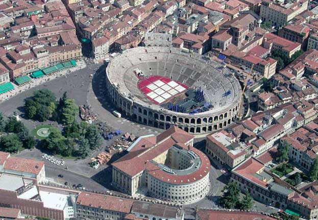
Because I went to Verona when I was only 12, the only thing that I remember is the Roman ampitheatre, one of the best preserved that exists in the world and one that is still used for concerts today. What I remember is that it was spectacular!
commons.wikipedia.org
Built in 30 C.E. outside of what was then the city in pink and white Valpolicella marble, it was almost destroyed in a 1117 earthquake. The Renaissance saw a revival of its use as a theater due to its excellent acoustics, and it has had a continuous summer season of concerts since 1813, except during the world wars. No electronic sound system was used until 2011, although the rock concerts of many famous bands probably used their own speakers -- Pink Floyd, Simple Minds, Duran Duran, Deep Purple, The Who, Dire Straits, Mike Oldfield, Rod Steward, Sting, Pearl Jam, Radiohead, and Muse.
www.guardian.co.uk
www.telegraph.co.uk
en.wikipedia.org
Source: http://en.wikipedia.org/wiki/Verona_Arena

Villa Romana del Casale Italy

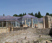
Villa del Casale at Piazza Armerina is the supreme example of a luxury Roman villa, graphically illustrating the predominant social and economic structure of its age. Its decorative mosaics are exceptional for their artistic quality and invention as well as their extent.An earlier rural settlement generally thought to have been a farm, although on slender evidence, existed on the site where the late Roman villa was built. Its orientation was the same as that of the baths of the villa, and its foundations were discovered beneath parts of the villa.

Villa Romana del Casale Italy
Continent: Europe
Country: Italy
Category: Cultural
Criterion: (I) (II) (III)
Date of Inscription: 1997

Residence of a rich tenant

The existence of baths in the earliest phase of the site suggests that it was the residence of a rich tenant or the steward of a rich landowner. Two portraits were discovered dating from the Flavian period (late 1st century AD) that may represent members of the owner's family. The stratigraphy of this earlier house provides a chronology from the 1st century AD to the Tetrarchy at the end of the 3rd century.

Villa Romana del Casale
Villa Romana del Casale Italy

Browse Gallery Plus UNESCO Storyline

Earlier house was destroyed by an earthquake

There are indications that the earlier house was destroyed by an earthquake in the first decade of the 4th century, by which time it was probably owned by Marcus Aurelius Maximinianus, a Pannonian who had risen from the ranks of the Roman army to become a general, and then was raised to the status of Augustus by Diocletian. On the violent death of Maximinianus in 310 it would have passed to his son and imperial colleague Maxentius, killed at the battle of Milvian Bridge in Rome in 312.

The grandeur and lavishness of the structure that arose on the ruins of the house suggests that it was built on the orders, if not of a Roman ruler, then by a rich and powerful landowner, between 310 and 340. It was occupied until the Arab invasion of the 9th century, although in a state of increasing degradation. The final act of destruction was the work of the Norman ruler of Sicily, William I the Bad, around 1155.

Slideshow for this Heritage Site


Browse All UNESCO World Heritage Sites in . The original UNESCO inscription Here!!!

Villa Adriana Italy

The Villa Adriana (at Tivoli, near Rome) is an exceptional complex of classical buildings created in the 2nd century A.D. by the Roman emperor Hadrian. It combines the best elements of the architectural heritage of Egypt, Greece and Rome in the form of an 'ideal city'. The Villa Adriana is a masterpiece that uniquely brings together the highest expressions of the material cultures of the ancient Mediterranean world. Study of the monuments that make up the Villa Adriana played a crucial role in the rediscovery of the elements of classical architecture by the architects of the Renaissance and the Baroque period. It also profoundly influenced many 19th and 20th century architects and designers.

Villa Adriana
Continent: Europe
Country: Italy
Category: Cultural
Criterion: (I) (II) (III)
Date of Inscription: 1999

Villa Adriana is a masterpiece

Villa Adriana is a masterpiece that uniquely brings together the highest expressions of the material cultures of the ancient Mediterranean world. Study its monuments played a crucial role in the rediscovery of the elements of classical architecture by the architects of the Renaissance and the Baroque period. It also profoundly influenced many 19th- and 20th-century architects and designers.

Villa Adriana Italy
Villa Adriana

Browse Gallery Plus UNESCO Storyline

The Historical Background

The villa covers more than 120 ha on the slopes of the Tiburtine Hills. It was originally occupied by a late Republican villa, the property of Hadrian's wife, Vibia Sabina. The imperial residence was built over it in AD 118-38. It was a symbol of a power that was gradually becoming absolute and which distanced itself from the capital. After Hadrian's death in 138, his successors preferred Rome as their permanent residence, but the villa continued to be enlarged and further embellished. Constantine the Great is alleged to have removed some of its finer pieces to his new capital, Byzantium.

The villa was sacked and plundered by successive barbarian invaders and fell into neglect, being used as a quarry by builders and lime-burners. Interest in the ruins was rekindled in the 15th century by Pope Pius II (Aeneas Silvius). Excavations to recover its glories were ordered by Alexander VI at the beginning of the 16th century. When Cardinal Ippolito II d'Este began to construct his nearby Villa d'Este he continued the excavations, supervised by his architect Pirro Ligorio, to obtain works of art to adorn it.

Slideshow for this Heritage Site


Browse All UNESCO World Heritage Sites in . The original UNESCO inscription Here!!!

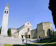
The Patriarchal Basilica of Aquileia Italy

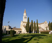
Aquileia one of the largest and wealthiest cities of the Early Roman Empire, was destroyed by Attila in the mid-5th century. Most of it still lies unexcavated beneath the fields, and as such it constitutes the greatest archaeological reserve of its kind. The patriarchal basilica, an outstanding building with an exceptional mosaic pavement, played a key role in the evangelization of a large region of central Europe. Aquileia was one of the largest and most wealthy cities of the Early Roman Empire. By virtue of the fact that most of ancient Aquileia survives intact and unexcavated, it is the most complete example of an Early Roman city in the Mediterranean world. The Patriarchal Basilica Complex in Aquileia played a decisive role in the spread of Christianity into central Europe in the early middle Ages.

The Patriarchal Basilica of Aquileia Italy
Continent: Europe
Country: Italy
Category: Cultural
Criterion: (III)(IV) (VI)
Date of Inscription: 1998

Aquileia was a major trading centre

Aquileia was founded by the Romans as a Latin colony in 181 BC in the north-eastern corner of the plain of the Po as an outpost against Gallic and Istrian barbarians. It quickly became a major trading centre, linking central Europe with the Mediterranean. By 90 BC it had been elevated to the status of municipium and its citizens were accorded full rights of Roman citizenship. Its wealth resulted in the town being endowed with many magnificent public buildings, and the private residences of its rich merchants were opulently decorated.

The Patriarchal Basilica of Aquileia

Browse Gallery Plus UNESCO Storyline

Spiritual significance

During the 4th century imperial residences were built in Aquileia, and it was the seat of the Imperial Mint between AD 284 and AD 425. Of particular importance was the construction in the second decade of the 4th century of a basilica, following the sanctioning of public worship by the Edict of Milan in 313. All this was to come to a violent end in 452, when Aquileia was sacked by the Huns led by Attila. Its mercantile role was assumed later by Venice. However, Aquileia retained its spiritual significance, becoming the seat of a patriarchate which survived until 1751, and played a key role in the evangelization of this region.

Slideshow for this Heritage Site


Browse All UNESCO World Heritage Sites in . The original UNESCO inscription Here!!!

Su Nuraxi di Barumini Italy

The nuraghi of Sardinia, of which Su Nuraxi is the pre-eminent example, represent an exceptional response to political and social conditions, making an imaginative and innovative use of the materials and techniques available to a prehistoric island community.During the middle and late Bronze Age (c . 1500-800 BC) on Sardinia a unique form of architecture developed: circular defensive towers in the form of truncated cones built from dressed stone, with corbel-vaulted internal chambers. Some (as at Barumini) were surrounded by quadrilobate enclosures consisting of towers linked by massive walls. Villages of small circular-plan houses developed around these strongpoints.

Su Nuraxi di Barumini
Continent: Europe
Country: Italy
Category: Cultural
Criterion: (I)(III) (IV)
Date of Inscription: 1997

Social and defensive reasons

The precise dating of the period of building the nuraghi on Sardinia is still the subject of debate among scholars, as there is some conflict between radiocarbon dates and those obtained by conventional archaeological stratigraphy. The influence of the Mycenaean tholos tombs, reflected in the corbelled roofs, now favours an earlier rather than a later dating. It is generally accepted that the central tower at Barumini dates from the later 2nd millennium BC.The central defensive structures are considered to have been built by single families or clans. As Sardinian society evolved in a more complex and hierarchical fashion, there was a tendency for the isolated towers to attract additional structures, for social and defensive reasons.

Su Nuraxi di Barumini Italy

Browse Gallery Plus UNESCO Storyline

Early Defensive Works

The major effort towards the extension and elaboration of the defensive works at Barumini is dated to the early Iron Age (10th-8th centuries BC) when Sardinia was exposed to Carthaginian incursions. It is significant that the larger nuraghic settlements of this type are located on those parts of the coast, or on the wide coastal plain of the eastern half of the island (as is the case of Su Nuraxi), that were most vulnerable to seabome attacks. It was during this period that the defences at Barumini and elsewhere were strengthened and the villages accreted around the central defences for protection. They became in effect small urban settlements, housing self-sufficient communities with their own range of craftsmen.

Slideshow for this Heritage Site


Browse All UNESCO World Heritage Sites in . The original UNESCO inscription Here!!!

City of Verona Italy

The historic city of Verona was founded in the 1st century B.C. It particularly flourished under the rule of the Scaliger family in the 13th and 14th centuries and as part of the Republic of Venice from the 15th to 18th centuries. Verona has preserved a remarkable number of monuments from antiquity, the medieval and Renaissance periods, and represents an outstanding example of a military stronghold. Verona is an outstanding example of a town that has developed progressively and uninterruptedly over two thousand years, incorporating artistic elements of the highest quality from each succeeding period. Verona represents in an exceptional way the concept of the fortified town at several seminal stages of European history.

City of Verona
Continent: Europe
Country: Italy
Category: Cultural
Criterion: (II)(IV)
Date of Inscription: 2000

City of Verona, Historical background

The city is situated in northern Italy at the foot of Monte Lessini on the River Adige. It was founded by ancient tribes and became a Roman colony in the 1st century BC, rising rapidly in importance. It was occupied by the Ostrogoth Theodoric I (5th century), by the Lombards, and by Charlemagne (774). In the early 12th century, it became an independent commune, suffering during the wars of Guelphs and Ghibellines. It prospered under the rule of the Scaliger family and particularly under Cangrande I. It fell to Venice in 1405, was part of the Austrian Empire from 1797, and joined the Kingdom of Italy in 1866.

City of Verona Italy
City of Verona

Browse Gallery Plus UNESCO Storyline

Verona and Historical Buildings

The core of the city consists of the Roman town in the loop of the river. The Scaligers rebuilt the walls, embracing a much larger territory in the west and another vast area on the east bank of the river. This remained the size of the city until the 20th century. The heart of Verona is the ensemble consisting of the Piazza delle Erbe (with its picturesque vegetable market) and the Piazza dei Signori, with their historic buildings, including the Palazzo del Comune, Palazzo del Governo, Loggia del Consiglio, Arche Scaligere and Domus Nova. The Piazza Bra has a number of classicist buildings.

Slideshow for this Heritage Site


Browse All UNESCO World Heritage Sites in . The original UNESCO inscription Here!!!

Cilento and Vallo di Diano National Park Italy

Cilento and Vallo di Diano National Park with the Archeological sites of Paestum and Velia, and the Certosa di Padula; The Cilento is an outstanding cultural landscape. The dramatic groups of sanctuaries and settlements along its three east–west mountain ridges vividly portray the area's historical evolution: it was a major route not only for trade, but also for cultural and political interaction during the prehistoric and medieval periods. The Cilento was also the boundary between the Greek colonies of Magna Graecia and the indigenous Etruscan and Lucanian peoples. The remains of two major cities from classical times, Paestum and Velia, are found there.

Cilento and Vallo di Diano National Park
Continent: Europe
Country: Italy
Category: Cultural
Criterion: (III)(IV)
Date of Inscription: 1998

Cultural landscape

During the prehistoric period, and again in the middle Ages, the Cilento region served as a key route for cultural, political, and commercial communications in an exceptional manner, utilizing the crests of the mountain chains running east-west and thereby creating a cultural landscape of outstanding significance and quality. In two key episodes in the development of human societies in the Mediterranean region, the Cilento area provided the only viable means of communication between the Adriatic and the Tyrrhenian seas, in the central Mediterranean region, and this is vividly illustrated by the relict cultural landscape of today.

Cilento and Vallo di Diano National Park Italy

Browse Gallery Plus UNESCO Storyline

Identified Homo sapiens

Cilento National Park is essentially a mountainous region cut by several river valleys sloping down to the Tyrrhenian Sea. The earliest human occupation identified in this region dates back over 250,000 years, when Homo erectus was living in caves along the coast. Homo sapiens replaced his Neanderthal cousin during the Upper Palaeolithic period and established seasonal camps during this and the subsequent Mesolithic period. Neolithic settlements have been discovered in a number of places across the area of the park. During the Bronze and Iron Ages small groups of warriors and traders moved into to the region.

Slideshow for this Heritage Site


Browse All UNESCO World Heritage Sites in . The original UNESCO inscription Here!!!

Portovenere Cinque Terre and the Islands Italy

The eastern Ligurian Riviera between Cinque Terre and Porto Venere is a cultural site of outstanding value, representing the harmonious interaction between man and nature to produce a landscape of exceptional scenic quality that illustrates a traditional way of life that has existed for 1,000 years and continues to play an important socio-economic role in the life of the community.The area covers some 15 km along the extreme eastern end of the Ligurian coast, between Levanto and La Spezia. It is a very jagged, steep coastline, which the work of man over the millennia has transformed into an intensively terraced landscape so as to be able to wrest from nature a few hectares of land suitable for agriculture, such as growing vines and olive trees.

Portovenere Cinque Terre and the Islands Italy
Continent: Europe
Country: Italy
Category: Cultural
Criterion: (I)(IV) (V)
Date of Inscription: 1997

Inhospitable nature

The human communities have adapted themselves to this seemingly rough and inhospitable nature by building compact settlements directly on the rock, with winding streets. The general use of natural stone for rooting gives these settlements a characteristic appearance. They are generally grouped round religious buildings or medieval castles.

Portovenere Cinque Terre and the Islands
Cinque Terre

Browse Gallery Plus UNESCO Storyline

Religious Activities

The five villages of Cinque Terre date back to the later middle Ages. The cultivation terraces that typify much of the Cinque Terre landscape were mainly built in the 12th century, when Saracen raids from the sea had come to an end. Starting from the north, the first is the fortified centre of Monterosso al Mare, on the top of St Christopher's hill, which first played an important role in the 7th century, during the Lombard invasions. After being disputed over by different noble families during the middle Ages, it threw in its lot with the Republic of Genoa. It is a coastal town in a valley; it's most prominent features being the church of St John, built in 1244, with its bell tower, originally an isolated watchtower, the ruins of the old castle, and the 17th-century Capuchin monastery that dominates the town.

Slideshow for this Heritage Site


Browse All UNESCO World Heritage Sites in . The original UNESCO inscription Here!!!

Costiera Amalfitana Italy

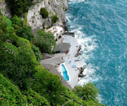
Costiera Amalfitana is an outstanding example of a Mediterranean landscape, with exceptional cultural and natural scenic values resulting from its dramatic topography and historical evolution. The area covers 11,231 ha in 15 Communes in the Province of Salerno. Its natural boundary is the southern slope of the peninsula formed by the Lattari hills which, stretching from the Picentini hills to the Tyrrhenian Sea, separate the Gulf of Naples from the Gulf of Salerno. It consists of four main stretches of coast (Amalfi, Atrani, Reginna Maior, Reginna Minor) with some minor ones (Positano, Praiano, Certaria, Hercle), with the mountain villages of Scala, Tramonti and Ravello and hamlets of Conca and Furore behind and above them.

Costiera Amalfitana Italy
Continent: Europe
Country: Italy
Category: Cultural
Criterion: (II)(IV) (V)
Date of Inscription: 1997

Amalfi was founded in the 4th century AD

Palaeolithic and Mesolithic materials have been found at Positano, and the area was favoured by the Romans, judging from the villas of Positano, Minori and Gallo Lungo. However, it was not intensively settled until the early middle Ages, when the Gothic War made it a place of refuge. Amalfi was founded in the 4th century AD. A new Roman colony in nearby Lucania came under barbarian attack and the inhabitants moved to the fertile and well-watered hilly area around modern Scala. In the first written reference to Amalfi (596) it was already a fortified town and the seat of a bishopric. It resisted Lombard attacks until 838, when it was conquered and looted by Sicardo. However, after his death the following year the town declared its independence.

Costiera Amalfitana
Costiera Amalfitana Italy

Browse Gallery Plus UNESCO Storyline

Distinctive Arab-Sicilian architecture

The new republic was governed by a ruler whose title had become Doge by 958. This political autonomy enabled Amalfi to become a maritime trading power between the early 9th and late 11th centuries, when the sea power of Byzantium was in decline and a free market developed. Amalfi had a near-monopoly of trade in the Tyrrhenian Sea, with vast networks of links, selling Italian products (wood, iron, weapons, wine, fruit) in eastern markets and buying in return spices, perfumes, pearls, jewels, textiles and carpets to sell in the West. The layout of the settlements showed eastern influence: the closely spaced houses climbing up the steep hillsides, connected by a maze of alleys and stairs, are reminiscent of the souks of the Levant. A distinctive Arab-Sicilian architecture originated and developed in Amalfi.

Slideshow for this Heritage Site


Browse All UNESCO World Heritage Sites in . The original UNESCO inscription Here!!!